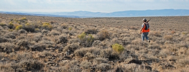
Hunting on private lands: UCAP and Regulated Hunt Areas
Regulated Hunt Areas (RHAs) are cooperative programs between Oregon Department of Fish and Wildlife and private landowners that offer regulated hunting on private lands. Each RHA has special regulations so be sure to check them before hunting.
The Upland Cooperative Access Program (UCAP) is an incentive-based program designed to provide quality public hunting opportunities for upland game birds on private lands in Wasco, Sherman, Gilliam and Morrow counties in the Columbia Basin.

These programs involve trust
ODFW trusts landowners to provide a reasonable amount of public access. Landowners trust hunters to remember they are guests on the land, follow the written restrictions, and abide by the spirit of respect and cooperation required to make these programs successful. Hunters repay that trust by leaving gates as they found them and picking up any litter, including shotgun shells.
Regulated Hunt Areas (RHAs)
Heppner RHA
This Regulated Hunt Area (RHA) provides access for big game and upland bird hunting opportunities. Closed to all motor vehicle use year-round unless posted otherwise, open fires and camping prohibited in posted areas. Approximately 23 sq miles in T3, 4, and 5S and R26, 27, and 28E.
Columbia River RHA
No entry permit required and open seven days-a-week. Hunt area boundary: Beginning at the eastern city limits of Arlington; east on I-84 to Threemile Canyon (mile post 151); north to the north side of the Union Pacific Railroad right-of-way; east on the railroad right-of-way to the boundary of the Umatilla NWR Boardman Unit; north to the Oregon/Washington state line; west on the Oregon/Washington state line to a point due north of the eastern city limits of Arlington; due south to the point of beginning.
Area is open for game bird, rabbit, and Eurasian collared-doves only during authorized game bird seasons. It is unlawful to use or possess shot other than federally-approved, nontoxic shot for all game bird hunting. Camping is allowed only at Quesnel Park (Threemile Canyon, miles post 151) within the posted safety zone; not to exceed 7 days in any consecutive 14-day period.
Port of Morrow RHA
Maps available at RHA entrance located by traveling north on Laurel Rd from exit 165 off I-84, 0.5 miles east on Columbia Ave and 0.3 miles southeast on Rippee Rd. No entry permit required and open 7 days per week Oct. 7 – Jan. 28. Area is open for hunting of game birds and Eurasian collared-doves only during authorized game bird seasons. It is unlawful to use or possess shot other than federally-approved, nontoxic shot. A map can be found here: http://www.dfw.state.or.us/maps/travel_management_areas/PortofMorrow.pdf
The Columbia River and Port of Morrow RHAs near Boardman in Morrow Co provide opportunities for public access and hunting for upland game birds and waterfowl. These areas are also subject to year-round road closures. The following are prohibited:
- Driving or being transported upon any area except for designated open roads.
- Hunting, entering, or shooting across closed areas and safety zones.
- Camping (use between 10 p.m. and 4 a.m.), except at Quesnel Park.
- Discharging rifles, handguns, or shotguns with slugs, except by specific ODFW authorization.
- Placing waterfowl hunting sites closer than 200 yards apart.
- Leaving decoys set out overnight (10 p.m. to 4 a.m.).
- Digging pit blinds.
Because of landowner concerns for safety and maintenance of agricultural operations, some areas may be temporarily closed. Hunter numbers will be limited if crowding occurs.
Upland Cooperative Access Program (UCAP)
UCAP is funded through the sales of upland game bird stamps, license dollars, and federal funds. Landowners who want to participate are compensated on a per acre basis to allow hunters access to their property for hunting. They provide hunters access to diverse hunting experiences and landowners receive payment for allowing access on their lands. ODFW provides landowners with all signs, permission slip booklets, patrolling and enforcement of the program rules. Landowners are relieved of liability issues related to UCAP.
Hunters must take the initiative to locate UCAP properties. General directions and maps to UCAP properties are available at the Heppner district office. However, the hunter is responsible for contacting the landowner to schedule a hunt on “Hunting by Permission” properties. The extra effort ensures landowners that only responsible hunters are guests on their land.
There are two main types of UCAP properties
Hunting with Permission: Indicated by yellow signs. After hunters locate a CAP property, they can use the name and phone number located on the sign to contact the landowner and schedule a hunt. This extra effort ensures landowners that only responsible hunters are guests on their land.
Welcome to Hunt: Indicated by green signs. Hunters are welcome to freely come and go. Hunters must locate the sign to determine which species they are permitted to hunt on each property as some properties only allow hunters to pursue certain species.
Most landowners (83%) provide “Hunting with Permission” while others (17%) opt for “Welcome to Hunt.”
All participating lands are clearly marked by one of these signs. UCAP signs are posted all year to allow hunters the opportunity for pre-season scouting.
Program regulations
It is unlawful to:
- Use a motorized vehicle on fields, trials and posted roads
- Hunt any posted safety zone or entry any "No Public Access" area
- Build or use open fires without landowner permission


