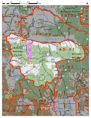
Boundary description
66% public land. Beginning at John Day; east on US Hwy 26 to Prairie City, southeast on Co Rd 62 to FR 13, southeast on FR 13 to FR 16, southwest on FR 16 to Seneca, south on US Hwy 395 to FR 3140, west on FR 3140 to Silvies Rvr, southwest on Silvies Rvr to Emigrant Cr, west on Emigrant Cr to FR 47/Hines Logging Rd, south on FR 47/Hines Logging Rd to FR43, west on FR 43 to FR 4370, west on FR 4370 to FR 41, northwest on FR 41 to Swamp Cr Ln, northwest on Swamp Cr Ln to Weberg Rd, northwest on Weberg Rd to Co Rd 112, northwest on Co Rd 112 to Co Rd 113, northeast on Co Rd 113 to Wolf Cr Rd, north on Wolf Cr Rd to FR 42, north on Buck Point Rd/ FR 12 to US Hwy 26, east on US Hwy 26 to John Day, point of beginning.
Please review the Big Game Regulations for sub-unit descriptions.
NOTE: This information is for reference use only, and is not intended to replace the information found in the current Big Game Regulations. Please consult the Big Game Regulations before purchasing tags or planning your hunting excursions.