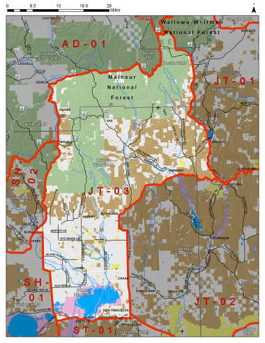
Boundary description
59% public land. Beginning at the US Hwy 20/OR Hwy 78 Jct in Burns northeast on US Hwy 20 to US Hwy 395; north on Hwy 395 to Seneca; east on Logan Valley Co Rd (FR 16) to FR 13; north on FR 13 to FR 1370; northeast on FR 1370 to Elk Flat Cr; east on Elk Flat Cr to the Little Malheur Rvr; south on the Little Malheur Rvr to the North Fork Malheur Rvr; south on the North Fork Malheur Rvr to US Hwy 20; west on Hwy 20 to Crane-Buchanan Rd (Harney Co Rd 312); south on Crane-Buchanan Rd to state Hwy 78; south on Hwy 78 to Lava Bed Rd (Harney Co Rd 404); south and west on Lava Bed Rd to Sodhouse Ln (Harney Co Rd 405); west on Sodhouse Ln to state Hwy 205; north on Hwy 205 to state Hwy 78; west on Hwy 78 to US Hwy 20 in Burns, point of beginning.
Please review the Big Game Regulations for sub-unit descriptions.
NOTE: This information is for reference use only, and is not intended to replace the information found in the current Big Game Regulations. Please consult the Big Game Regulations before purchasing tags or planning your hunting excursions.