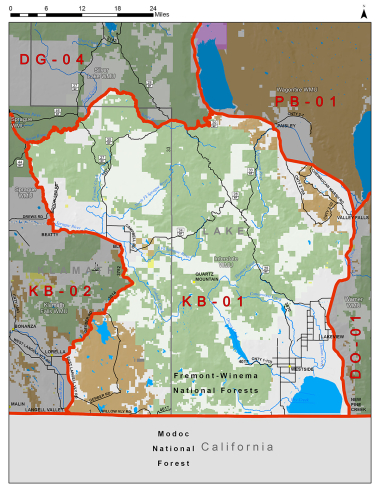
Boundary description
56% public land. Beginning at Bly; west on State Hwy 140 to Beatty; north on Godowa Springs Rd to Sprague Rvr; west on Sprague Rvr one mile to Sycan Rvr; upstream north and east on Sycan Rvr to Pikes Crossing/NF 30; east on NF 30 to NF 28; southeast on NF 28 to NF 29; east on NF 29 to State Hwy 31; southeast on Hwy 31 to Valley Falls; south on US Hwy 395 to Oregon-California state line; west on state line to Lost Rvr; northwest on Lost Rvr to East Langell Valley Rd; north on East Langell Valley Rd to Gerber Rd; northeast on Gerber Rd to Bly, point of beginning.
Please review the Big Game Regulations for sub-unit descriptions.
NOTE: This information is for reference use only, and is not intended to replace the information found in the current Big Game Regulations. Please consult the Big Game Regulations before purchasing tags or planning your hunting excursions.