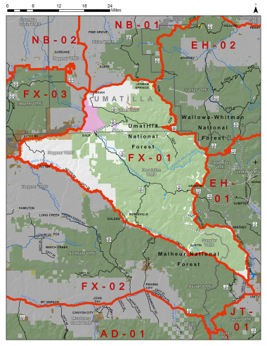
Boundary description
82% public lands. Beginning at Ukiah east on State Hwy 244 to Tower Mt Rd/ FR 5226, south on Tower Mt Rd/ FR 5226 past Frazier Forest Camp and Tower Mt to Granite-Ukiah Rd/ FR 52, southeast on Granite-Ukiah Rd/ FR 52 to FR 73, south on FR 73 to FR 10, west on FR 10 to FR 13, south on FR 13 to FR 1305, south on FR 1305 to Greenhorn Rd, southeast on Greenhorn Rd to State Hwy 7, east on State Hwy 7 to N. Fork Burnt Rvr Rd, south on to N. Fork Burnt Rvr Rd to Rice Rd, south on Rice Rd to Rouse Ln, southwest on Rouse Ln to US Hwy 26, northwest on US Hwy 26 to State Hwy 7, north on State Hwy 7 to Co Rd 20, northwest on Co Rd 20 to US Hwy 395, west on the Middle Fork John Day Rvr to the confluence of the N Fork John Day Rvr, northeast on the N Fork John Day Rvr to the confluence of Camas Creek, follow Camas Creek northeast to Hwy 395, north on US Hwy 395 to State Hwy 244, east on State Hwy 244 to Ukiah, point of beginning.
Hunt Maps within this Hunt Area
FX601 Fox 01 Map
Please review the Big Game Regulations for sub-unit descriptions.
NOTE: This information is for reference use only, and is not intended to replace the information found in the current Big Game Regulations. Please consult the Big Game Regulations before purchasing tags or planning your hunting excursions.