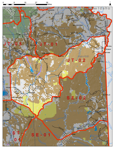
Boundary description
73% public land. Beginning at the junction of state Hwy 78 and Crane-Buchanan Rd (Harney Co Rd 312) near Crane; north on Crane-Buchanan Rd to US Hwy 20; east on Hwy 20 to Cairo Junction; south on US Hwy 20/OR Hwy 201 to Oregon-Idaho State Line in Nyssa; south on Oregon-Idaho state line to the Owyhee Rvr; southwest on the Owyhee Rvr and Owyhee Reservoir to the Dry Cr Arm of Owyhee Reservoir; west on the Dry Cr Arm of Owyhee Reservoir and Dry Cr to Crowley Rd (Malheur Co Rd 585); southwest on Crowley Rd and Crowley-Riverside Rd (Malheur Co Rd 513) to OR Hwy 78; northwest on Hwy 78 to Crane-Buchanan Rd, point of beginning.
Please review the Big Game Regulations for sub-unit descriptions.
NOTE: This information is for reference use only, and is not intended to replace the information found in the current Big Game Regulations. Please consult the Big Game Regulations before purchasing tags or planning your hunting excursions.