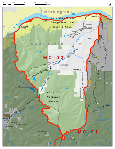
Boundary description
65% public land. Beginning at Hood Rvr; southwest on State Hwy 35 to Barlow Pass (Pacific Crest Trail); northwest on Pacific Crest Trail to Lolo Pass; northwest on Hood Rvr-Multnomah Co line to Columbia Rvr near Bonneville; east on Columbia Rvr to Hood Rvr, point of beginning.
Hunt Maps within this Hunt Area
MC102-1 Early Mid-Columbia 02 Map
Please review the Big Game Regulations for sub-unit descriptions.
NOTE: This information is for reference use only, and is not intended to replace the information found in the current Big Game Regulations. Please consult the Big Game Regulations before purchasing tags or planning your hunting excursions.