Boundary description
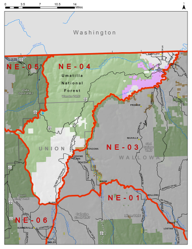
73% public lands. Beginning at Troy; southwest on Grande Ronde Rvr to Elgin; northwest on State Hwy 204 to Tollgate; northeast on FR 64 to Oregon- Washington state line; east on state line to Grande Ronde Rvr; southwest on Grande Ronde Rvr to Troy, point of beginning. (Maps: Umatilla NF, ODF).
Hunt Maps within this Hunt Area
NE104M Northeast 04 Muzzleloader Map
Please review the Big Game Regulations for sub-unit descriptions.
NOTE: This information is for reference use only, and is not intended to replace the information found in the current Big Game Regulations. Please consult the Big Game Regulations before purchasing tags or planning your hunting excursions.