Search myodfw.com
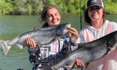
Features: Kokanee are silvery in color until they are ready to spawn, at which time they become reddish. They do not grow as large as sockeye- their ocean traversing siblings. They can vary significantly in size depending on how densely populated the waterbody is. Since they are filter feeders, their populations can quickly expand and contract with the availability of food. Habitat: Kokanee can be found at all depths of cold, clear lakes and reservoirs in several parts of the state. They will change which depth they are at depending on water temperature. Technique: They are a challenging fish to…

The European starling is considered an invasive species in Oregon. It was introduced from Europe. They most closely resemble blackbirds, with which they often flock in fall and winter. While both have iridescent plumage, starlings can be told from blackbirds by their two-toned wing pattern - dark upperwing, pale underwing - and during the breeding season by the bright yellow bill. Starlings adapt readily and quickly to human habitation and are highly efficient and successful breeders. However, the abundance of the bird, the rapidity with which it has spread across North America, and its propensity to cause damage to crops…

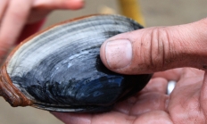
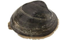
Features: The purple varnish clam is named for the purple hue found inside the clam and the shiny varnish over the brown color outside the shell. It is oval in shape and is relatively flat with a prominent ligament near the hinge. Habitat: These clams can be found in cobble to muddy substrate. Technique: Purple varnish clams are found in very high densities. Limits are 72 a day. Learn more here before getting started clamming. See Oregon Sport Fishing Regulations for information on the daily catch limits for bay clams. How to dig purple varnish clams (video)


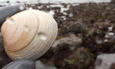
Features: Circular in shape and 1.5-2.5 inches across. Identified by concentric lines and radiating ridges. Longer lived and less abundant than cockles. Habitat: High salinity areas of sand, mud, gravel, or rock. Harvest them in Tillamook, Netarts, Yaquina, and Coos bays. Techniques: These clams can be found in rocky nearshore areas within 6 inches of the surface. Using a rake for these clams is the best harvest method. Learn more here before getting started clamming. See Oregon Sport Fishing Regulations for information on the daily catch limits for bay clams. How to dig for little neck clams (video)
Features: Unlike gaper clams, softshell clams have no gape on their neck end. Softshell clams have a spoon like projection on the left valve, this feature is called a chondrophore. Habitat: Brackish, muddy areas all along Oregon's coastline. Find softshells 12-18" depth. Technique: Softshells can be harvested by digging with either a shovel or clam gun. As the name suggests, they have soft or thin shells which are easy to break. Although a clam with a broken shell is still good to eat, sharp edges of a broken shell can be very dangerous. Until you've refined your shoveling skills you…
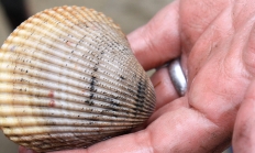
Features: Identified by its prominent radiating ridges. Habitat: Cockles are "hard shelled" clams. Their protective, stout shells and short siphons mean that they do not have to bury as deeply as other common bay clams. Good cockle beds will often have cockles right on top of the sand on a good tide. They prefer sandy areas with high salinity, but can be found at many types of tideflats. Technique: The best clamming is during low/minus tides. Because these clams are so near the surface, you rake, rather than dig, for them. A four prong gardening rake is perfect for raking…
Features: Dungeness crab can sometimes be confused with rock or other crab species. However, it is easily identified by its white-tipped claws and reddish-brown to purple color. Habitat: Adult Dungeness crab forage on a number of fish and invertebrate species. They can be found throughout the sandy and muddy areas in the shallowest parts of lower estuaries all the way to depths of almost 1,500 feet. Techniques: There are many kinds of crab catchers – from crab pots and rings, to traps you can cast with a fishing rod. You can easily crab from a dock in many coastal bays…


SALEM, Ore.—Everyone can fish, clam and crab for free in Oregon on Saturday and Sunday, June 7-8, 2025. No fishing/shellfish licenses or tags (including a Combined Angling Tag or Columbia River Basin Endorsement or Two-Rod Validation) are required on these days. Both Oregon residents and nonresidents can fish for free. Oregon…
Features: Gaper clams have large "neck" housing the two siphons that protrude above the substrate surface when feeding. Protective leathery plates are found just below the siphon tips and feel rough to the touch. Gapers are unable to retract their neck entirely into the shell, producing a "gape" in the shell. It is common for algae to grow on their necks and gaper pea crabs to dwell inside the shell with the gaper clam. Habitat: Gapers can be found in high salinity sandy and/or muddy areas in most of Oregon's larger estuaries. Tillamook, Netarts, Yaquina, and Coos are favorite bays…


Features: Butter clams have oval and oblong shaped shells with heavy, thick valves and hinge. Their shells have fine concentric rings. When the shell is open a little, you can see the pale ruffled mantle reminiscent of a tuxedo. Like the gaper clam, they have their two siphons fused together into one "neck." Average adult size is 3-4 inches but can range up to 5 inches. Butter clams can live more than 20 years. Habitat: Butter clams can be found in a wide variety of substrates but prefer sand and gravel/cobble beaches. They live approximately 6-12 inches deep and can…
SAUVIE ISLAND WILDIFE AREA, Ore.— To manage ongoing traffic and parking problems at Sauvie Island Wildlife Area's beaches, ODFW is introducing a new limited-entry parking pilot program. Starting July 4, vehicles will need a free Sauvie Island Beaches Pass in addition to the Wildlife Area Parking Permit ($10 daily) to…
