

2024 big game hunting forecast
A quick guide for early season hunters
ODFW wildlife biologists offer a look at the habitat conditions and hunting outlook for the upcoming season.
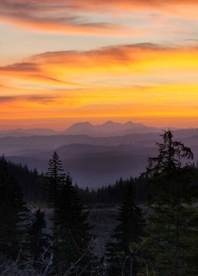
Most of Oregon enjoyed a mild, long winter with ample precipitation running through spring. Unfortunately, summer came quickly with high temperatures and little to no rain in June, July and August, leading to the early onset of wildfire season.
When hot, dry conditions mark the start of the hunting season, hunter will benefit from:
- Being aware of fire restrictions and closures that can limit access.
- Spending time scouting to locate animals where more water and forage is available.
Check current drought conditions throughout the state.
What to know about CWD
Chronic Wasting Disease (CWD) is a fatal disease infecting deer and elk across North America. While CWD has not yet been detected in Oregon, it has been found in all surrounding states – Idaho, California, and Washington. We have a chance to manage CWD if both hunters and wildlife managers work together. Get your animals tested and educate yourself and others about CWD.
Chronic Wasting Disease check stations
2024 opening weekend deer rifle season:
2024 0pening weekend rifle Rocky Mtn elk season:
|
Smaller check stations will also be open in some districts throughout the state, and hunters should contact their district directly for more information on potential locations.
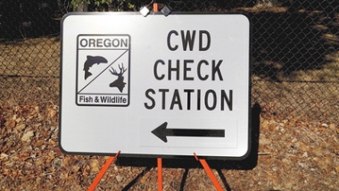
If you encounter a CWD check station while transporting an animal carcass you are legally required to stop.
Find out more about ODFW's efforts to prevent and monitor the spread of CWD to Oregon.
Other ways to get your animal tested
If you do not encounter a check station, there are several other ways to get your animal tested, from visiting an ODFW office to using a participating taxidermist/meat processor who can collect and submit samples for you. Learn more about other ways to get your animal tested.
For more information on CWD, as well as a link to the Online CWD Testing Results Portal, please visit www. MyODFW.com/CWD.
Out of state hunters: Don't bring home banned animal parts
If you harvest a deer, elk, moose or caribou in any other state or Canadian province, it is illegal to bring certain parts of the animal back into Oregon. Banned parts include any central nervous system tissue of an animal, which includes the brain and spinal column. For more guidance on what parts can be brought into Oregon, please see the Parts Ban section under General Hunting Regulations (page 16) in the 2024 Big Game Hunting Regulations.
Fire restrictions – Know before you go
While fire season is still in effect, most forests will have restrictions on activities and motorized use, and some private lands will be closed to public access. You'll find links to fire restriction the latest updates for both private and public lands on MyODFW.com. Remember it's your responsibility to know and follow any restrictions. Here are some of the common fire season restrictions:
- Campfires may be either prohibited or only allowed in approved campgrounds.
- Smoking and off-road driving (including motorcycles and ATVs) may also be prohibited in most areas.
- You must have in your vehicle either 1) a gallon of water, or 2) a fully charged and operational 2½-pound fire extinguisher and shovel (except when travelling on state or county roads).
- ATVs must have a charged and operational 2½ pound fire extinguisher.
Regulation changes for 2024
- There's a new late season controlled archery white-tailed deer hunt that includes all of Murderers Creek and Northside units, and a portion of the Beulah Unit. (See page 38 in the 2024 Oregon big game hunting regulations.)
- The addition of five new youth buck hunts in southeast Oregon units. (See page 40.)
- An increase in California bighorn ram tags and additional ewe tags for some hunts. (See page 62.)
Look for other regulation changes, which are highlighted in yellow in the online regulations and booklet.
Resources on MyODFW.com
The ODFW website has several helpful resources for deer and elk hunters, including:
- A hunter's checklist to help you start planning early, and remember what to carry in the field.
- Things you can do to help prevent the spread of chronic wasting disease to Oregon
- 10 tips for being a better cougar hunter
- A look at how to hunt deer and elk in Oregon
- Seasonal Recreation Report with monthly updates on conditions and access, plus tips and techniques.
- Scout from home to find good habitat using the Oregon Hunting Access Map.
Wolves are present in Oregon
As Oregon's wolf population continues to expand geographically, hunters need to take extra care to identify their target. Wolves can look like coyotes, especially wolf pups in the mid-summer and fall. Please report any wolf sightings or wolf sign online with the Wolf Reporting Form.
Test your identification skills with ODFW's new Coyote and Gray Wolf ID Quiz.
Note: The area updates are organized by wildlife management units (WMUs) that are used to help organize hunting seasons.
Northwest Area
In general, it seems that deer and elk survived the variable winter pretty well. Access to private timberlands for the opener of deer and elk archery season will be dependent on the level of rainfall in the coming weeks. As the rifle deer opener approaches and fire danger decreases, more and more previously closed private lands will open to hunting.
At this time, private and public land restrictions are changing frequently due to on-going extreme drought conditions and wildfires. Please check the online resources to find closures before leaving for your hunting adventures. If a resource hasn't been updated recently, then try contacting the land manager directly during their business hours.
Saddle Mt., Wilson, Western Trask, Western Stott Mt., Western Alsea, North Siuslaw WMUs
DEER
Black-tailed deer on the north coast (Saddle Mt., Wilson, western Trask wildlife management units) endured winter well with only average post-winter mortality noted.
Deer densities overall are moderate and estimates of buck escapement from last year's hunting season were at benchmark (~20 per 100 does) for the Saddle Mtn. and Trask units and above average in the Wilson. Any of the three WMUs should offer decent buck hunting prospects.
There has been a lot of recent clear-cut timber harvest on state forestlands, so be sure to take a look at ODF lands if scouting for areas to hunt deer. Generally, deer densities tend to be highest in the eastern portions of these units.
Most industrial forestlands will be open to at least non-motorized access once fire season is over, with the exception of Weyerhaeuser lands, most of which will continue to be in a fee access program this fall.
The 2024 General Any Legal Weapon Western Oregon Tag has a start date set for Oct. 5, this is a few days behind last year as we start moving the dates back based on the new hunt structure. This late start date is expected to cause an excellent hunting season as bucks may be rutting during the end of the season.
Along the Mid-Coast (western Stott Mountain, western Alsea, north Siuslaw), overall deer numbers and buck ratios appear to be stable and fair to good in most areas. Deer densities remain higher on private land compared to public land. The success rate for the 2022 General Any Legal Weapon Western Oregon tag was lower than 2021, but more akin to the 5-year average for all three units.
Winter deer surveys revealed that the fawn ratio for the Alsea and Stott Mountain units were above the 5-year average while the Siuslaw was below the 5-year average. Buck ratios for all three units were either slightly below or equal to the 5-year average. A colder than normal winter may have caused some additional overwinter mortality but was most likely mitigated by an excellent growing season in 2022.
Deer hunters should focus on areas of edge habitat with early successional habitat adjacent to mature timber and thick cover. Edge habitat provides deer with ample forage and cover. Focus on clear cuts, riparian areas, forest gaps, montane meadows, and thinned timber stands to find deer foraging in the early morning and late evening hours. These habitat types are often found on private commercial timber properties, but can also be found on public land and at the borders of public and private land.
The Stott Mtn/North Alsea Weyerhaeuser and Manulife Access and Travel Management areas (TMA) provide some quality walk-in hunting opportunities. Manulife and Weyerhaeuser Access and Habitat open lands utilize yellow TMA road closed signs where motor vehicles are not permitted. Road closures and hunting access is year-round. Be aware of Weyerhaeuser lease and/or permit areas and please visit their recreation website for more information on access. Please obtain a TMA map online (Map 1) (Map 2) for more information on travel management in the North Alsea and Stott mountain units. Check the Oregon Department of Forestry's website for current fire information. The TMA will be closed to vehicle access at Industrial Fire Protection Level 3 (IFPL3) and will be closed completely at IFPL 4.
Most private timber lands in Stott and Alsea are currently open to motor vehicle and/or walk-in public access due to Access and Habitat grants but please pay attention to fire season restrictions as they can change at any time. Lands in the Siuslaw unit are under more restrictive fire use and are likely closed during fire season. Keep up to date by checking the Oregon Department of Forestry website or calling landowners. You will find links to Forest Service, BLM, and other landowner websites with updated fire closure information here.
ODFW is currently testing harvested deer and elk for Chronic Wasting Disease (CWD). CWD is a neurological disease that is highly transmissible among ungulates and is always fatal. While CWD has not been detected in Oregon, it has been detected nearby in Idaho and was recently detected in both Washington and California. Please, contact your local ODFW office or find a CWD check station to get your animal sampled. Remember, it is now mandatory to stop at a CWD check station if you are transporting harvested wildlife. Also remember that there are restrictions on the parts of deer and elk that can be brought into Oregon from out of state.
Saddle Mountain Unit
Deer densities remain favorable throughout the Unit. Some areas to look at include Vollmer Creek, Green Mountain, the lower Klaskanine, Young's, Lewis and Clark and Necanicum rivers in Clatsop County, and Fall, Deer and Crooked creeks in Columbia County.
While much of the unit is industrial timberland, most timber companies offer plenty of walk-in access in some areas and open gates for dawn to dusk vehicular access in others, once the fire season is over. See the newly revised 2022 North Coast Cooperative Travel Management Area map from ODFW for details.
Wilson Unit
Clear-cut habitat continues to be created on state (ODF) and private industrial forestlands. Areas with recent logging include the North Fork Wilson River, North Fork Nehalem River, Standard Grade, Buck Mtn. and the upper Salmonberry River. Deer populations continue to be on the increase, with decent buck to doe ratios.
Trask Unit
On state forestlands in the western portion, look in the upper Trask River and Wilson River basins. On industrial forestlands, the upper portions of the South Fork Trask River and Widow Creek along Hwy 18, as well as Cape Lookout and Cape Meares blocks, have a lot of good habitat.
ELK
On the north coast (Saddle Mt., Wilson, western Trask) elk populations are at moderate levels, but continuing to increase, and are at their highest in the western portions of these WMUs. Bull elk hunting this year should be okay in the Wilson and Trask units due to good bull escapement from last year's hunting seasons. Bull ratios are above Management Objective in both.
Some popular hunting areas In the Wilson Unit are the lower Wilson River, God's Valley, Cook Creek, upper North Fork Nehalem River, Standard Grade, Buck Mtn. and Camp Olson.
In the Western Tract unit, hunters will find higher numbers of elk and open habitats include Cape Lookout, Cape Meares, Fall Creek, lower Nestucca River and the Trask River, especially the South Fork.
Both WMUs have general season archery and rifle hunting opportunities. Bag limit is any bull for archery and 1st rifle seasons and spike only for 2nd rifle.
The Saddle Mountain also had good bull survival from the last several seasons, but bull rifle hunting is through controlled hunting only and the bag limit for rifle and archery is 3-point or better. Areas with higher elk numbers and open habitat include Clatsop Ridge, Davis Point, the lower Klaskanine River, Young's, Necanicum and Lewis and Clark Rivers, and Ecola Creek.
For archery elk hunters, most industrial forestlands will be open to at least non-motorized access once fire season is over, except for Weyerhaeuser lands, most of which will be in their fee access program this fall.
The Mid-Coast (Western Alsea, Western Stott Mountain, North Siuslaw) elk populations are stable and fair to good in most areas. Observed calf ratios were higher during this past year compared to the previous year and bull ratios were either slightly lower (Siuslaw) or remained stable (Alsea, Stott Mountain).
Remember that the second rifle bull elk season in Siuslaw WMU has a bag limit of one spike bull; the bull ratio there continues to be highly variable year-to-year but appears to be showing signs of a slight decrease but is still above Management Objective.
Elk in the Siuslaw Unit are highly scattered and difficult to find, and most larger herds are on private farmland or commercial timberland. Spend time contacting private landowners for access and scouting to find elk sign as the topography is rugged in certain portions of this unit.
Early successional habitats such as clear-cuts, plantations, and agricultural land interfaces have the highest densities of elk. U.S Forest Service lands south of Hwy 20 have lower densities of elk and are much more difficult to hunt in the thick older growth vegetation and rugged terrain. However, hunters can find elk in thinned areas, powerline corridors, mountain meadows, and grassy riparian areas.
Stott Mountain and Alsea units
The Stott Mtn/North Alsea Weyerhaeuser and Manulife Access and Travel Management areas (TMA) provide some quality walk-in hunting opportunities. Manulife and Weyerhaeuser Access and Habitat open lands use yellow TMA road closed signs where motor vehicles are not permitted. Road closures and hunting access is year-round. Be aware of Weyerhaeuser lease and/or permit areas and please visit their recreation website for more information on access.
Please obtain a TMA map online (Map 1) (Map 2) for more information on travel management in the North Alsea and Stott mountain units. Check the Oregon Department of Forestry's website for current fire information. The TMA will be closed to vehicle access at Industrial Fire Protection Level 3 (IFPL3) and will be closed completely at IFPL 4.
Some popular areas to hunt elk in the Stott Mountain Unit include the South Fork Siletz River, Fanno Ridge, Gravel Creek, Mill Creek, Elk Creek, Euchre Creek, Murphy road, and the mainstem Siletz River.
Popular elk hunting areas in the Alsea include the South tract 1000 line, Yachats River, Five Rivers, North Fork Siuslaw River, Big Rock Creek Road, Luckiamute River, Airlie, Burnt Woods, Grant Creek, Wolf Creek, Logsden, Pee Dee Creek, and Dunn Forest.
ODFW is currently testing harvested deer and elk for Chronic Wasting Disease (CWD). CWD is a neurological disease that is highly transmissible among ungulates and is always fatal. While CWD has not been detected in Oregon, it has been detected nearby in Idaho. Please, contact your local ODFW office or find a CWD check station to get your animal sampled. Remember, it is now mandatory to stop at a CWD check station if you are transporting harvested wildlife.
Hunters are also asked to report any limping elk or elk with deformed hooves as this can be a sign of Elk Hoof Disease (Treponeme associated hoof disease). If your animal has a deformed hoof, ODFW may request it for testing.
BEAR and COUGAR
The bear outlook is fair to good for the north coast (Saddle Mt., Wilson, western Trask). While cougar densities are generally lower than other coastal units, bear densities are moderate and both species tend to increase from north to south and from east to west, with the highest densities in the southwestern portion of the Trask WMU. This year's berry crops were much better than last year's with blackberries starting to come on strong now, so bears will most likely be out in open areas such as clear-cuts during the early part of the season.
During the midday hours, predator calling can be very productive, and is best done with a calling partner to maximize calling effort and detection of bears and cougars as they approach the area.
Bear populations along the Mid-Coast (Western Alsea, Western Stott, North Siuslaw) are healthy and have been benefitting from an abundant berry crop this year. Most bears are harvested while hunters are looking for deer and elk. If you are hunting specifically for bears, focus on areas with large numbers of berries.
As the summer comes to an end and fall begins, bears will enter hyperphagia (excessive eating) in preparation of winter hibernation. During this time hunters can find them throughout the day gorging on berries and other food sources.
Bears are more abundant closer to the coast than on the Willamette Valley side of the coastal mountains. Most industrial forestlands in the Alsea/Stott units are typically open to access during the fire season thanks to Access and Habitat funds but check their websites or hotlines to confirm.
Recommended units to hunt cougars are the Stott Mtn., Alsea, and Siuslaw in particular, west of Dallas, west of Dawson, and south and west of Philomath. As with bears, predator calling is by far the most effective way to harvest a cougar other than spotting one while hunting deer or elk. Most cougars are harvested by hunters during the deer and elk hunting seasons so do not forget to purchase and carry a cougar tag.
Scappoose, Eastern Trask, North Willamette, North Santiam WMUs
DEER
Fall deer herd composition surveys completed in 2023 indicated similar trends to previous years for the eastern Trask, northern Santiam and Scappoose units. Surveys are not conducted in the Willamette Unit. Fawn ratios were essentially average in the Scappoose, eastern Trask, and the northern Santiam units.
Currently there are some road closures on the Mt. Hood National Forest due to the Sandstone Fire. Fire danger remains elevated to a level that many private industrial timber companies will be closed to public access during the opening weeks of archery season. Hunters are reminded to contact local timber companies to obtain updated access information and check the Oregon Dept. of Forestry's website for fire restrictions and closures. State and federal lands typically remain open during the archery season and provide the primary hunting opportunities.
Hunter access to most of Weyerhaeuser lands in the Scappoose, eastern Trask and north Santiam WMUs is limited to those hunters who purchased an entry permit. However, even these lands may be impacted in early hunting seasons if fire danger is high-extreme.
Most Rayonier Forest Resources parcels joined the North Coast TMA in 2023, which allows public hunting access to additional property in Columbia County, primarily in the Scappoose unit. Hunters can request a 2024 North Coast or Upper Tualatin-Trask Travel Management Area map showing landownership and access opportunities from the northwest Oregon ODFW district offices.
Most properties in the Willamette Unit are privately-owned and hunters are reminded to obtain permission before hunting on those lands.
Remember to pay careful attention to the bag limit and identification characteristics of your quarry. White-tailed deer and hybrids have been documented across northwestern Oregon where only Columbian black-tailed deer are legal for harvest.
Scappoose Unit
Deer herd composition surveys in the Scappoose unit resulted in a buck ratio that fell slightly below the benchmark of 20 bucks per 100 does in the fall of 2024. However, this is in line with the 5-year average for that unit.
Public access in the Scappoose unit is very patchy. There is typically more opportunity for hunters willing to hunt areas closed to motorized vehicles but open to public walk-in. There are multiple timber companies in the unit that allow walk-in access when Industrial Fire Precaution Levels are below 2. Some companies to consider looking into for access potential are Hampton, Stimson, Campbell Global, and Lewis & Clark Timberlands.
Rayonier Forest Resources properties are now accessible to public hunting via the North Coast TMA in the Scappoose unit. Some areas to locate deer this fall include Tater Hill, Long Mt., Serafin Point, Burgdorfer Flat, Buck Mt. Bunker Hill, Baker Point, Bacona, and the hills above Pebble Creek.
East Trask Unit
Some areas in the eastern portion of the Trask unit with good big game habitat include the upper portions of the Yamhill and Tualatin Rivers, Trask Mountain, Barney Reservoir, Pumpkinseed Mt., Green Top, and Willamina Creek.
Buck ratios observed during the fall 2023 herd composition surveys was around 16 bucks per 100 does for the eastern portion of the unit, which is right on par with the past 5-year average and is slightly below the 20:100 benchmark.
North Santiam Unit
The north Santiam Unit buck ratios were slightly lower than those observed in 2023 and at benchmark ratios. Prospects should be good this season for those hunters who are able to obtain access and are willing to hunt thick cover where deer concentrate. Additional camera trap surveys in the Santiam revealed many large bucks still present across the unit following the 2023 Any Legal Weapon season.
Hunters will find a wide diversity of terrain in the WMU, ranging from high elevation meadows, thick, old-growth forests, industrial forestlands and agricultural fields, so a variety of hunting styles can be used.
Whether hunters choose to still hunt, set up a tree stand on a promising game trail, rattle antlers, or conduct deer drives, scouting will be critical for success and to ensure access to your favorite hunting locations. Areas that were burned in the 2020 wildfires may be productive for local deer populations and can be good places to hunt with the appropriate amount of caution.
The USFS has been opening up portions of that area to public access, including access to popular hunting locations up Hwy 224, which has been closed since the fires occurred nearly three years ago. Hunter access in the north Santiam is still limited in 2024, compared to previous years, due to continued closures of portions of the unit for safety concerns and rehabilitation efforts resulting from the Riverside, Beachie Creek, and Lion's Head fires of 2020. In addition, some roads in the Mt. Hood National Forest are currently closed due to the ongoing Sandstone Fire.
Information regarding current access & closures can be found on the Mt. Hood National Forest website or on the MyODFW.com website.
North Willamette Unit
For hunters who drew a Willamette tag (615), the long hunting season in the Willamette Unit should provide a very good opportunity to harvest a deer this season. Deer damage to agricultural crops remains high throughout the northern portion of the unit.
Hunters are reminded that land within this unit is primarily privately owned and hunters will need to have landowner permission to legally hunt most properties.
Hunters can find some public land hunting opportunities in the Willamette River area. Some of these areas have special restrictions (e.g., shotgun or archery only), so hunters should pay close attention to regulations. Many of the hunting spots are also listed on ODFW's Hunting Access Map.
ELK
Scappoose and East Trask units
Elk populations in the Scappoose and eastern Trask are above the commission adopted management objective of 10 bulls per 100 cows.
Antlerless elk tags available to hunters have been significantly increased since the institution of the General Season Antlerless Elk hunt in the east Trask and Willamette Units. The General Season Antlerless Elk tag is now currently valid in a small southern portion of the Scappoose unit.
This hunt is entirely on private land so make sure you have access to a plot of private land before you purchase a tag. ODFW staff will not be able to assist you with finding a place to hunt (see pg. 44 of the 2021 Big Game Hunt Regulations).
In the Scappoose WMU, elk are more numerous in the timberlands of the northwestern portion of the unit. Herds in this unit tend to be "smaller", typically ranging 15-60 animals, compared to the eastern Trask where there are multiple larger herds that range between the timber lands and agriculture lands.
Most Weyerhaeuser lands in the Scappoose, eastern Trask and northern Santiam WMU's are limited to those hunters who have a lease agreement or acquired an access permit, with the exception of the Weyerhaeuser property near Turner Creek in the eastern Trask that is in the North Coast TMA.
Some areas to consider in the Scappoose unit include Upper McKay Creek, Green Mountain, Buck Mt., and Bunker Hill. In the eastern Trask, hunters wanting to do more walk-in hunting should be looking at the Upper Tualatin-Trask Travel Management Area west of Forest Grove as a good option. Other areas to consider include Trask Mt., Stony Mt., Windy Point and Neverstill.
North Santiam Unit
Elk numbers within the Mt. Hood National Forest have declined over the past few decades, which will make for challenging elk hunting on public lands. Hunter success should be average on lower elevation private timberlands. Hunters heading for the Mt. Hood National Forest will find elk highly scattered and difficult to locate. Scout early and often to be successful there.
Places to begin scouting include the areas around Timothy and Olallie Lakes in addition to meadow complexes along open sections of the Oregon Skyline Rd (NF 42). At lower elevations, hunters should explore Butte Creek, Upper Molalla River and Eagle Creek.
Closures resulting from the 2020 fire season are still affecting significant portions of the north Santiam unit, but it's likely that areas closed for nearly three years will be opening soon, likely in time for rifle hunting seasons this year. Ensuring that you have access prior to the start of season will be crucial for hunter success.
BEAR and COUGAR
Bears in the eastern slopes of the Coast Range will be concentrated near areas with good berry loads. Few bears are checked in from the Scappoose Unit, however habitat is similar to the Trask and should have some areas for good bear hunting if access can be found.
In the northern portion of the Santiam unit high densities of bears continue to provide relatively good hunting opportunities. Visibility on the landscape is what will make bear hunting the northern Santiam difficult. We recommend keying in on good food resources (huckleberry patches, chokecherries, etc.) and scouting for frequent bear activity.
Many areas with high bear densities are heavily forested and don't provide much opportunity for glassing. Predator calling may be a tactic worth exploring in the northern Santiam.
The cougar population in the Scappoose and East Trask units appears to be on the rise; however, higher densities of cougar in the northern Santiam Unit should provide hunters with their best chance for success.
Successful hunters found predator calls that mimic a prey species were very effective. For safety, hunters should always have a partner along when predator calling. Tracking cougars through fresh snow near concentrations of deer and elk is another proven technique.
S. Santiam, McKenzie WMUs
DEER and ELK
Some of the areas that burned in 2020-2023 are now open for public access, but others still remain closed.
Consult with the land manager before going hunting if you are planning to hunt within any of the areas that have burned in the last few years. And while some of these areas may have reopened to access, big game may not move into the newly opened habitat for another two to three years.
Hunters who know about habitat, take the time to scout and then hunt hard, will have the best chance for success. Populations are strongly tied to habitat conditions and hunting prospects are fair to good in places with high quality habitat. Hunting prospects are poor in lower quality habitats.
Forage is key to good deer and elk habitat. Early seral (brush and forb) forest conditions provide some of the best deer and elk forage. On public lands, early seral habitat is often found in areas not burned severely by wildfire and may be found in thinned areas if the enough trees were removed. On private timberland, forage is best in clear-cuts beginning a couple years after the timber harvest.
South Santiam Unit
Surveys this previous winter continue to show both elk and deer meeting management objectives for bull and buck escapement. Elk numbers are down from historic numbers, but hunters can still find animals on both public and private ground if they're willing to put in the scouting time. Deer are more evenly distributed across the unit and numbers are similar to recent years.
Many lands that burned in the 2020-2023 fires still need more time to recover before they will start benefitting big game populations and access is still restricted in some areas. Hunters can find elk around the edges of the burned areas and near thinning operations or other openings created by the Forest Service.
At lower elevations in the Cascade foothills, look for elk and deer in two- to eight-year old clear-cuts. Elk are most plentiful at the timber/agricultural interface. Additionally, hiking into areas closed to motor vehicles increases your odds of finding both deer and elk.
McKenzie Unit
The East Lane Travel Management Area (TMA) will be open 7 days a week from the opening of the Western Cascade General Buck Deer season until the end of the Cascade Bull season. The 39,825-acre TMA is comprised of dispersed blocks of land located in the McKenzie and Indigo units. Maps will be available at access point kiosks just prior to the TMA opening. Be sure to pickup a new map because roads designated for motor vehicle access have changed in most blocks.
Geo pdf maps can also be downloaded from our website and used on a smart device with its GPS feature enabled. The Geo pdf maps will show your location as you move around the TMA. Users must download the Avenza application to use in conjunction with the maps.
BEAR and COUGAR
Bears are abundant on both private and public lands. The key to bear hunting is to hunt their natural food sources. Bears key on berry crops during the fall hunting season including but not limited to raspberries, trailing blackberries, cascara, Armenian blackberries, huckleberries, madrone, and manzanita. Find a ripe food source and watch it both morning and evening; don't forget to consider the wind and try to avoid spooking the bear.
Water sources, such as a small pond or swamp, can attract bears that want to take a swim to cool off. Overall bear prospects are good as they are abundant on both private and public lands.
Most hunters take cougars opportunistically if they have a tag. Cougars are abundant but secretive. They can be found anywhere that deer and elk are found. If you want a chance to bag a cougar, buy your tag in case you see one while you are hunting or scouting other game.
Southwest Area
Current black-tailed deer research in ongoing in a number of wildlife management units in the southwest area. Preliminary results show the local deer population is stable or slightly higher than previous projected.
The long-term weather forecasts indicate El Nino conditions will develop this fall. Often this creates an extended fire season. Hunters need to check with landowners to determine their access policies particularly if the hunter plans to hunt on private lands in the early fall.
W Tioga, Powers, and portions of Sixes WMUs
The Coos Mountain Access Area is open for public use. Only roads marked with green dots are open to vehicle traffic. All other roads are open to walk-in access or bike access. E-bikes are considered motor vehicles and are restricted to green dot roads. Private landowners within the Coos Mountain Access Area are within their rights to close roads on a case-by-case basis if the roads are being used for administrative purposes such as logging or road construction.
DEER
Deer populations in the district seem to have been increasing over the past several years. ODFW survey and research work has indicated deer populations in many parts of the Tioga, Sixes and Powers units are fairly high in comparison to population levels of the early 2000s. However, they may have leveled off in more recent years.
The National Oceanic and Atmospheric Administration's fall and winter weather forecast indicates there is a higher likelihood that we will experience La Niña weather conditions this year than last year. La Niña conditions result in wetter and cooler conditions. Usually there is a greater likelihood of snow accumulation in higher elevations and flooding in lower elevations. If this forecast plays out hunters should expect more rain during the fall seasons and snow accumulations later. This will cause deer to focus feeding on south slopes where sun exposure warms the soil resulting in better vegetative growth.
Hunters with early-season bow tags should still focus on north slopes since the feed will be better there but hunters with tags that allows them to hunt later in the fall may find better opportunities on south slopes. ODFW research has shown that local deer prefer grassy clearcuts. While they feed both on browse and grass, research has shown grass is a more important component in their preferred habitats. As a result, hunters should look for young clear-cuts dominated by grasses and forbs, which deer seem to prefer.
Winter survival for deer appears to have been good. There were some reports of mortality due to Deer Hail Loss Syndrome, but indications are that this impact was not significant. Based on surveys conducted after the close of the season last year, the buck ratios locally are at the benchmark for deer. Last year also indicated a relatively large fawn crop with good survival occurred so deer populations may increase as a result.
While the number and size of fires in Coos County appears to be relative low at this writing, this could change as conditions are very dry. Hunters can find local fire information at the Coos Forest Protective Association's website.
ELK
Elk populations in the Sixes, Powers and Tioga Units are at or close to the management objectives for these units. However, with relatively low calf ratios, according to survey results, elk populations in local units may be in a declining trend. Bull ratios looked better in Powers Unit from these surveys. Also, the bull ratio appears to be strong in the Sixes Unit. However, the bull ratio may be down in Tioga Unit. Unfortunately, due to poor weather conditions during the survey period Tioga was not surveyed well this year. ODFW will be watching the bull ratio in Tioga closely.
Private timber lands can be very productive due to timber harvest activities, though hunters will need to find out if there is public access to these properties. Public land where there have been timber thinning operations also can be good places to concentrate hunting effort. Elk on the coast will look for areas with minimal disturbance and relatively flat terrain. Experienced hunters will use a map to find places with low road density and relatively flat topography.
BEAR and COUGAR
The highest bear densities appear to be near the Umpqua River close to the coast. Anecdotally it appears bear populations were negatively affected by the winters of 2021-22 and 1022-23 in Coos and coastal Douglas Counties. It appears bear numbers locally may have declined those winters possibly due to the poor berry production that occurred during the corresponding summers. This year, however, it appears bears survived better. So, hunters should find reasonable high bear populations this year.
Bear hunting opportunities will be best near blackberry patches and streams in the early part of the fall season. These patches can be found in creek bottoms and clear-cuts or along deactivated forest roads that are "brushing in." Good moisture early in the growing season and warm conditions have contributed to a very good wild fruit production year. Bears will be keying in on blackberries and other wild fruits until those options go away in the later fall. Bears can be taken with a tree stand or ground blind set up near berry patches or fruit trees associated with old homesteads. They tend to get comfortable going to these places to feed and are less wary.
The berry crop of 2024 seems to be very good. Black berries are plentiful and the berries themselves are large and full. Other berry sources such as evergreen huckle berries, thimble berries and cascara are productive this year, as well. This means there should be waves of berry production through the summer and fall. Bears will use this to their advantage. Bear hunters should, too.
In addition to hunting bears around places where they are feeding on fruit, calls imitating calf elk of fawn deer might bring bears to hunter. Because bears are big predators that can move through the woods almost silently, it's a good idea to hunt in pairs. One person to call while the other keeps an eye out for approaching bears. Many experienced bear callers recommend calling continuously for longer than you might for other predators. This is because bears seem to lose interest if calling is sporadic.
Cougars are difficult to locate in Coos County. Most cougars are taken incidentally during deer and elk seasons by hunters who have also purchased a cougar tag.
Other hunters find success using predator calls in areas where the hunter finds fresh cougar sign or areas where deer and elk concentrate. Cougars will often approach calls slowly and they are easily distracted if calling is not consistent. Many cougar hunters find electric calls to be useful tools to hunt cougars. Fawn or calf distress calls may be the best choice for hunting.
Dixon, Indigo, Evans Creek, Melrose, E Tioga and NE Powers WMUs
DEER and ELK
Deer hunting should be decent in Douglas County this fall. Spring surveys indicate good over-winter survival for deer in the Douglas portion of the Umpqua District. The fawns ratios in the Dixon, Indigo and Melrose continue to be stable to increasing over the last few years.
Also, with the elk season shift there is no longer a gap in the Cascade units for general deer season. It now runs the same time as the rest of western Oregon general deer season -- Oct. 5 - Nov. 8 for 2024.
Elk numbers in the Tioga Unit are close to population management objective and doing well. Higher elevation elk populations in the Cascades continue to trend downward, and elk will be difficult to find in these areas.
Elk hunters in the Cascades have averaged around a 5 percent success rate over the past few years and this year is expected to be similar. Cascade rifle elk hunters should be aware that the season has been shifted to November -- Nov. 9 - 15 for this year.
All archery and rifle hunters hunting the first part of the season should be aware of fire restrictions and access issues. Currently the Douglas County area is under extreme fire danger and IFPL III, this prohibits access to private timber company property. Make sure to check access restrictions where you are planning to hunt. Oregon Department of Forestry Fire page has links for corporate timber closures.
Also be sure to double check the ownership of timber company land you wish to hunt. New companies are purchasing land in the area and public access policies are changing.
Hunters should be looking at clear-cuts, thinning's or wildfire scars for deer and elk activity. Recent fire activity in the Dixon, Evans Creek and Indigo units are already producing good forage and cover for deer populations. Focus on fire scars from 3-5 years ago.
Hunters unfamiliar with this area are advised to hunt smarter, not harder. Use Google Earth or Google Map (satellite layer) to explore the area with a birds-eye view and get an idea of the terrain and vegetation. Get a hold of some good maps from the Forest Service/BLM/Local Fire Protection Association and use them in conjunction with Google Map to locate areas away from roads that will provide you a quality hunting experience.
Another good source of information is to view historic fire perimeters online at Geomac. These maps will give you an idea where large areas have been opened up by wildfire, which enhances forage opportunities for deer and elk.
North Indigo Unit
In the Indigo, the Tumblebug Fire that burned in the upper Middle Fork Willamette drainage improved deer habitat, and the deer population in the area is expected to improve over the next few years. Additionally, the US Forest Service and sporting organizations such as Oregon Hunters Association and Rocky Mountain Elk Foundation have been hard at work thinning old clear-cuts to improving forage conditions south of Hills Creek Reservoir. These habitat projects will help maintain the deer and elk populations in the area.
Still, the strongest deer and elk populations occur on private lands where expansive timber harvest results in improved forage. Please remember to check access restrictions before hunting on private lands.
BEAR and COUGAR
There was enough rain this spring that berry crops are good. Locating these berry crops and looking for bear sign should be productive. Predator calling can also yield good results, focus on using a fawn distress call in early morning and late evening. Hunters can expect a good harvest year as bear numbers continue to be robust.
During hot dry weather, bears will be found around cooler wet drainages, with the best times in early morning and late evenings. The Chetco and Applegate units have had the best success during the fall season, although bears are found throughout the three counties in very healthy numbers.
Cougars are found throughout the district and can be hunted all year long. They are challenging to hunt, but many hunters increase their odds by using of predator calls along major ridgelines. Don't forget to purchase a tag since most cougars taken today are by hunters pursuing other species.
Applegate, Chetco, Evans Creek, Rogue, portions of Dixon, and Sixes WMUs
DEER
Current data shows the recent 3-year average buck ratio for the local deer population are above benchmark within the district. In general, the Rogue, Dixon, Evans Creek and Applegate units within Jackson County have mostly migratory deer populations. Most of the winter migration happens somewhere around mid-October. Within these units hunting at higher elevations (above 4,000 ft.) during the early half of the season and lower elevations (below 4,000 ft.) during the last half of the season, after deer have migrated, may be a great strategy for harvest success.
The concentration of migratory deer on winter range during the rut provides especially good hunting opportunity for archery hunters in the Evans Creek and Rogue, and for muzzleloader hunters with a tag for the Applegate. Deer in Josephine and Curry counties are more likely to be found at all elevations throughout the season, only getting pushed out of the higher elevations with large weather events.
Big game hunting statistics indicate that most units within Jackson, Josephine and Curry counties had a hunter success last year consistent with previous years. The Rogue unit's hunter success in the general deer rifle season was 25 percent, Evans Creek 47 percent, Applegate 39 percent and the Chetco 41 percent success. However, over the past four years deer hunter harvest has remained roughly the same in all five units, indicating that this year should be the same. Compared to 2023, it will be slightly dryer conditions so hunters should be aware of any potential fire restrictions and take that into consideration while determining areas to hunt.
Remember to check local restriction when it comes to campfires as well as hunting on private timber company land during fire season.
ELK
Elk harvest numbers for had a similar success rate in 2023 as compared to previous years. For archery hunters, early season elk may not be very vocal and locating them may be more difficult than later in the season. During the early season when it's hotter and drier, look for water sources and cool/shaded north facing hillsides where elk tend to spend their time during the heat of the day.
As the season progresses and cooler temperatures prevail, elk will begin the rut. They will become more vocal, and cow-calling or bugling may be a great way to locate them. Keep in mind that food consumption in preparation for the winter will also be a priority for elk. Grassy pocket meadows and windswept ridgelines may be a great place to locate elk.
During the Cascade Any Weapon Elk season, we partner with the Forest Service to implement the Upper Rogue Travel Management Area to provide hunters with larger tracts of untraveled roads to hunt in the Rogue Siskiyou National Forest. Hunters should focus on this closure area as it can provide elk an escape from more heavily trafficked roads, which they tend to avoid. Upper Rogue and other TMA maps can be found https://www.dfw.state.or.us/maps/here.
This year the Cascade elk season will be slightly earlier than last year, but still later than most times in recent years. Because of this, hunters should be mindful of potential weather related impacts that may occur on travel and camping. Based on our season framework, elk seasons will progressively get earlier in upcoming years. On the coast, both seasons of the Chetco unit controlled rifle hunt showed the same consistent hunter success as in previous years.
BEAR and COUGAR
All indicators are that bear numbers remain high. Bears are found throughout all units. Densities in southwest Oregon are high with Applegate continuing to produce the highest harvest in the district and third highest in the state during fall season.
Berry crops in many areas are abundant as of mid-August, most likely due to the wet weather we had this spring as well as good snowpack we had this past winter. To find bears, look for the areas that are producing with blackberries, huckleberries, manzanita berries, choke cherries, acorns and for recent feeding activity by bears (fresh droppings). Depending on the weather, the bears may be at these food sources all day or towards the late afternoon when cooler weather prevails.
Hunters may also find success in bear hunting by using fawn-in-distress calls to draw bears out from heavy cover. Set up in a spot that gives you a good view of the area and keeps your scent away from approaching bears. A fawn in distress call may also draw in other predators like cougar, bobcat, coyote and fox.
Cougar numbers continue to remain stable. Because of their elusiveness, cougars are best hunted during other big game seasons, although hunters have had success with predator calls. Targeting cougars after recent snows where tracking conditions are good can be successful. Cougars have large home ranges and use major ridgelines to travel. If you know a cougar has moved through an area, they likely will again. Going back to the same area as often as possible to increase your chances of being there when it shows back up. Make sure to be prepared this hunting season and purchase a cougar tag just in case you happen to run into one.
Columbia Area
Fawn and buck ratios in the fall of 2023 were higher than past years indicating populations are stable or increasing within all units. Winter conditions were relatively mild and over winter survival was high which should translate to an abundance of yearling bucks on the landscape. Elk numbers are stable in this area. Heavy cover can make for challenging conditions in the forested portions of these units.
This summer has been warm and dry with extreme fire conditions. Several wildfires have occurred within the district which may disrupt ungulate movements and utilization of the landscape. Hunters may be affected by these fires due to recent closures on the Mt.Hood National Forest, county forest, and private timberlands
A significant portion of the Hood unit is currently closed to public access due to fire activity and extreme fire danger. Currently all Green Diamond and Twin Creeks Timberland within this unit are closed to all public access due to extreme fire danger. Hunters can find the most up to date closure information on their website located here.
The Whisky Creek Fire is also actively burning within this unit on the Mt.Hood National Forest near the confluence of Whisky Creek and Herman Creek. A significant portion of the Mark O. Harfield Wilderness area is currently closed due to this fire. A map and up to date information on this closure can be found here.
Hood River County Forest Lands also have several closures in place due to the Whisky Creek Fire. HRC currently has closed all trails and roads to the west of trail 140. A map and up to date information can be found here.
Within the White River Unit a large portion of the White River Wildlife Area on Postage Stamp Butte burned in the Larch Creek Fire. This area is still open to the public for hunting, but the burn may disrupt deer distribution and movement patterns in this area. There are currently no closures on the national forest within unit 41 but be sure to check for updated access and fire restrictions on the Mt. Hood National Forest's website before you head out.
Hood, White River, Maupin, West Biggs WMUs
DEER
Deer populations within the West Biggs unit appear to be stable or increasing. Surveys conducted in the fall of 2023 estimated a sex ratio of 18 bucks:100 does which is above the management objective of 15. Fawn ratios were significantly higher than the last two years with an estimated ratio of 47 fawns:100 does.
With a relatively mild winter, there should be a surplus of young bucks available for harvest within the West Biggs Unit this fall. In this unit, buck ratios are highest in northern end of the John Day River canyon and on private lands, where public access is limited. Be sure to ask for permission if you intend to hunt private lands in these units.
The John Day River area has limited public access points but can offer a great hunting experience when accessible. Floating the river can provide hunters access to public lands within the canyon but is highly dependent on flows. Water levels in the John Day are at average for summer flow, but public access will be dependent on timing of fall rains. Hunters planning on floating should check water levels here before heading out.
Public access points within the canyon (Cottonwood, Thirtymile, etc.) will be dependent on fire danger, but should be accessible. The Deschutes River canyon also offers public land hunting opportunities throughout BLM and Lower Deschutes Wildlife Area. Deer densities here are typically lower than in the John Day canyon, but pressure from adjacent private lands can push more deer into the higher elevations along the canyon rim after opening day.
Deer numbers within the Maupin unit are below historical averages but fawn production and buck ratios are stable and above management objectives. Fall surveys indicated a buck ratio of 34 bucks per 100 does which is significantly higher than the 20-year average. Fawn production was slightly down from years past with an estimated ratio of 34 fawns per 100 does. This unit is dominated by private land with public access being limited to small chunks of BLM land. Be sure to know where you are hunting and ask for permission if you intend to hunt private lands.
Deer in the White River Unit appear to be slowly recovering after a population decline in 2016 due to a hemorrhagic disease outbreak, drought and poor forage conditions. Last fall's fawn ratio was up from the 10 year average with an estimated 48 fawns per 100 does. Buck ratios are also up from past years with an estimate of 26 bucks:100 does, which is slightly above the management objective of 25 bucks per 100 does.
Most deer within the White River unit spend their summer on the western edge of the unit at higher elevations or on private lands adjacent to agriculture. Hunters should start their search at higher elevations to get away from other hunters to locate a buck to harvest
The deer population in the Hood unit has been historically difficult to monitor with typical survey methods due to dense vegetation and lack of visibility when flying. New methodologies using trail cameras are being used to estimate deer abundance and herd composition within this unit. Determining accurate age and sex ratios is difficult using this technique but results from the fall suggest a buck ratio well above management objective. This population appears to be stable with an abundance of bucks available for harvest. Difficult terrain, thick vegetation and behavioral patterns of these deer limit hunter success within the Hood Unit.
The best hunting in the Hood unit is on private timberlands, accessible primarily through Green Diamond Resource property. A map of open Green Diamond land can be found here. Hood River County Forest land is also a great place to locate a buck at dusk and dawn. Hunters should target clear cuts that have been recently logged in the last five years that are providing abundant forage.
The Hood Unit also has several large fires that occurred in recent years on the North side of Mt. Hood and along the Columbia River Gorge that can provide quality hunting opportunities. Newly emerged woody browse and other vegetation make these burns an excellent place to focus efforts.
ELK
Elk populations district-wide remain relatively stable in all units. Bull ratios from the most recent survey in the White River Unit were 9 bulls per 100 adult cows, which is slightly below the management objective of 10 bulls:100 cows. Reproduction of calves remains steady with a calf:cow ratio of 21 calves per 100 cows. Success has been slightly above long-term averages for the past couple of seasons.
Hunters will find elk in scattered herds throughout the forested areas of the White River and Hood units. Public lands in both units are dominated by dense vegetation. More open areas within the forest created by recent burns and logging provide good forage for elk as well as excellent glassing opportunities. In contrast to deer, elk are much more likely to avoid roads and concentrations of people. Hunters who are willing to make the extra effort to get away from roads and cover lots of ground will have a higher chance of success.
Most elk in the Maupin and West Biggs units are found on private lands. These units are managed as elk deemphasis areas and have low densities throughout. General season antlerless elk damage hunts within these units provide additional opportunities for hunters to harvest a cow. Make sure you get permission from the landowner before hunting private lands in these units. A few elk can be found on BLM and state lands in these units and hunting pressure is very low.
BEAR and COUGAR
Both bear and cougar populations are good in the White River and Hood Units. Cougars are often seen moving throughout the canyons of the Deschutes and John Day River systems, as well as on White River Wildlife area later in the fall as deer and elk migrate in from high elevation. Predator calling and locating a fresh kill are great strategies.
Bear hunters should focus on clear-cuts or natural openings in the forest, especially those with good berry or acorn crops. Most bears are harvested by hunters pursuing deer and elk during the rifle season but fall bear hunting can also be great in the early season when huckleberries are ripe. In general, the Hood unit offers higher bear densities, but dense vegetation makes seeing a bear more difficult.
Central Area
Once again, we had a mild, long winter with ample precipitation running through spring. Unfortunately, June, July and August have been devoid of rain, leading to a quickly drying landscape and an early onset fire season.
Riparian areas and meadows continue to have ample water fed from a high water table, however, venturing much beyond these mesic habitats the vegetation dries out quickly. Wildfires have taken hold in much of eastern Oregon and the Ochoco district has experienced its fair share of flare-ups. Most notably the Crazy Creek fire in the Ochoco unit is impeding recreational opportunities and management decisions are still being made affecting its hunting seasons.
Tag holders should be on the lookout for emails from ODFW regarding hunt status' and all hunters should follow public land closures enacted by the Forest Service and BLM. Please follow all fire restrictions as the landscape is still fire prone.
Ungulate species will still most likely be seen at higher elevations early in the season, but hunting water features across the landscape at different elevations should still be a successful strategy.
Maury, Ochoco, Grizzly WMUs
DEER
Buck ratios are near management objectives for the Maury, Ochoco, and Grizzly units, with a district-wide average of 20 bucks per 100 does.
Ochoco and Maury fawn survival were decent and consistent with last year. Grizzly fawn counts were high again, once again showing a rebound from 2022's all-time low.
Archery hunt harvest rates decreased across all units last year despite cool weather and favorable hunting conditions. Rifle hunt harvest success rates remained stable across all units.
Throughout the district, deer populations continue to be lower than management objectives due to overarching drought effects as well as the usual suspects: habitat loss and fragmentation, poaching, predation, disease and roadkill.
Changes have been made within the Rager TMA. So, please remember to pick up a motor vehicle use map for the Ochoco and Deschutes National Forests, so you know what roads are open and closed.
ELK
The bull ratios in all three units are below management objective, with bull ratios in the Maury historically low. The elk population in the district is decreasing slowly, yet hunter harvest last fall was about average (≈25 percent) throughout the district.
The Ochoco and Grizzly herd populations are holding steady compared to last year. The Maury unit has seen a rather steep decline, and harvest success seems to be erratic from year-to-year. The Maury elk herd appears to not be utilizing the available habitat during the same time of year as it used to and only a handful of individuals can be found during the fall season. Tagholders in the Maury will have their work cut out for them.
Typically, elk hunting improves as you get further away from open roads. With small streams flowing late into the summer, expect animals to remain up high early in the hunting season.
The Maury and Ochoco units offer the most public land hunting opportunities, while the Grizzly unit is mostly private land where access can be difficult. Ochoco unit rifle hunters are reminded the Rager and South Boundary TMA motorized vehicle restrictions will be in effect. Maps of those areas are available on ODFW's website and from ODFW and Ochoco National Forest offices, as well as signboards as you enter the TMAs.
Most public land cow elk tags have been eliminated in the Ochoco unit due to declining elk populations on national forests. Private land hunts for the Ochoco unit are intended to increase elk use on the national forest and eliminate elk staying on private lands throughout the seasons.
BEAR and COUGAR
Bear and cougar populations appear to be stable or increasing. Predator harvest rates in the Ochoco district are modest compared to other hunting districts. We encourage hunters to explore these predator-hunting opportunities between big game seasons as you will likely not encounter any other hunters while out enjoying the time afield.
With the amount of quality forage available this year, concentrate time and energy on drainages with noticeable berry crops and fresh sign. While time behind glass is the tried-and-true method for finding bears, most haven't heard a predator call and will be quick to investigate an animal-in-distress call.
Cougars are more widely dispersed throughout all three units and generally will be associated with deer, elk, or pronghorn. During the winter, following fresh tracks and periodic predator calling has been effective for some hunters.
Areas to consider scouting include: Maury Mountains, Salt Creek, and S.F. Crooked River (Maury unit); Lookout Mountain, upper Bridge Creek, and South Fork John Day River (Ochoco); and Mill Creek and Green Mountain (Grizzly).
Upper Deschutes, Paulina, Metolius, N. Wagontire WMUs
DEER
Overall deer populations are below desired management objective district wide. As usual, weather conditions prior to and during hunting seasons will have a big impact on hunting conditions and success. With the season being a few days later than usual this year it could offer better hunting conditions.
Favorable spring conditions and more available water should better distribute deer throughout the district. The wet spring conditions helped to supply better and more abundant water and forage in the desert regions.
Buck ratios are near, or above, management objective district-wide with an average of 25 bucks per 100 does. Last winter's tolerable conditions resulted in stable over-winter survival district-wide with a ratio of 57 fawns per 100 does.
Low survival rates in both fawns and adult deer continues to push populations below management objective in all units. Habitat loss, disturbance, poaching, predation, disease and roadkill are contributing factors.
ELK
Elk numbers are stable in the East Central Cascade units. Low calf recruitment of 18 calves per 100 cows contributes to the slow growth in the district. Populations are at or near management objective in all units. Favorable winter conditions resulted in good overwinter survival.
Wet spring conditions provided better than average forage and should help distribute elk throughout the coniferous habitat. Lower elevation habitat continues to be dry with fewer numbers of elk.
Hunter densities are high in the roaded portions of the Cascade units. For solitude, seek more remote wilderness and roadless areas in the Cascades.
PRONGHORN
Pronghorn numbers are steady throughout the district. Favorable wet spring conditions gave vegetation a needed boost and there is more available water distributed over the landscape which should better distribute the pronghorn throughout the desert habitat.
Our recent surveys showed a good number of available mature bucks and recruitment of yearling bucks looks good at this point for future hunters.
When in pronghorn habitat, remember to camp away from water sources as they are critical to wildlife, especially in drought conditions. Camping near water sources can restrict wildlife access due to fear of humans.
South Central Area
Late winter and early spring snowfall transitioned into a drawn-out and wet spring. This helped get the region out of prolonged drought conditions and provided excellent forage throughout the summer. Some extremely late snow did have some negative effects in Lake County to some populations of fawns and other young of the year.
Keno, Klamath Falls, Sprague, Ft Rock, and Interstate WMUs
DEER
Deer populations in Klamath County overall are decreasing slightly. Klamath Falls, Keno, and Interstate WMUs are above buck ratio Management Objective (MO).
Winter conditions were moderate this year and spring fawn ratios were at or slightly below maintenance levels to maintain current populations for the second year in a row, which is an improvement over the last few years.
The district-wide spring fawn ratio was a slightly higher than the previous year on the east side of the South Central Area and similar to recent years on the west side. Yearling bucks (last year's fawns) generally comprise over half the buck harvest.
Hunters should concentrate efforts in areas with healthy understory vegetation or thinned areas that offer good forage availability adjacent to cover, especially if weather is hot and dry.
In the absence of significant moisture before or during the hunt, expect deer to be more nocturnal in their movements and focus on areas within a few miles of water. Deer will also select for dried up, seasonal creeks.
Summer wildfire activity has been low in Klamath County, though conditions remain extremely dry. Fire related restrictions on campfires will likely remain in place through much of the early fall hunting seasons.
Always check with the landowner/ land manager before starting your hunting trip. You'll find links to Forest Service, BLM and other landowner websites with updated fire closure information here, and additional updates in the Recreation Report. As the hunter it is your responsibility to make sure the area you plan to hunt is open and accessible.
ELK
The Cascade Mountains (that area within Klamath County west of Hwy 97) offer the best opportunities for elk hunting in the Klamath District. The Keno Unit and those areas within the Sprague and Fort Rock Units west of Hwy 97 are limited entry only (231X-SE Cascades) through controlled hunts. Bull ratios are above management objective and some older age bulls are available. Best prospects are in the Keno and Fort Rock Units.
Elk numbers are lower in the eastern part of the county, and rifle seasons east of Hwy 97 are controlled hunts. Overall population trends are stable to slightly increasing in some areas but still below population management objectives. General season archery hunters will have a bull-only bag limit in all units with the exception of the Fort Rock unit east of Hwy 97 where an either-sex bag limit is in effect.
BEAR and COUGAR
The Cascade Mountains region (Keno, Sprague, Fort Rock west of Hwy97) and the Interstate Unit have the highest concentrations of bears in the Klamath region. Hunters are reminded to purchase bear and cougar tags prior to opening day of buck season. Hunters can purchase an additional general fall bear tag.
Though cougar populations appear stable, harvest in the units is generally low. Harvest of cougars is generally incidental to deer and elk hunting and is evenly distributed throughout the district. Focused cougar hunting efforts are most successful later in the year after low elevation snow events when tracks can be observed. Finding a fresh cougar kill, or using a predator call, can also be an effective way to hunt cougars.
East Interstate, Silver Lake, East Fort Rock, Warner, and West Beatys Butte WMUs
DEER
Deer populations in Lake County continue to be below management objectives. Significant wildfires during the summer of 2021 have further reduced some populations in the short term primarily in Interstate. These fires are beginning to produce the forage and conditions that will benefit the deer population, and we have observed strong fawn survival so far this year.
Buck ratios across most of the county are at or near management objectives. Fall fawn ratios averaged 49 across all units, which will translate into fewer younger-age bucks available. Winter survival was good this past year, with a mild winter, and some good early-spring precipitation.
Fire weather conditions have been in the "extreme" category for the past several weeks. Conditions will continue to be dry without significant precipitation. You will find links to Forest Service, BLM and other landowner websites with updated fire restrictions and closure information here, and additional updates in the Recreation Report. As a hunter, it's your responsibility to make sure the area you plan to hunt is open and accessible.
At the time of writing, we currently have one large fire burning in the county: the Warner Peak fire located on Hart Mountain NAR. This fire has led to the cancellation of a few hunts due to the refuge being closed to public access. We are actively monitoring the fire and will take further action if necessary.
Some suggested areas to hunt and further breakdowns for hunters less familiar with the Lake District:
East Interstate Unit
Buck ratios remained strong, yet fawn ratios dipped this past fall. Much of this unit has burned in the last six years from fires including: Watson Creek (2018), Brattain (2020), Bootleg (2021), Cougar Peak (2021) and Patton Meadow (2021). Portions of these burns have begun to produce higher quality forage and therefore are attractive to deer. Other portions were more severely burned and have yet to begin producing forage.
Targeting the areas along the fringes of these fires with new growth and water could be a good strategy. Hunters reported good success last year, primarily due to the increase observability of the deer within those fire-scars. If you are hunting the fire-scars, be aware of snags that tend to fall in windstorms.
Silver Lake Unit
While as much as 18 percent of the unit burned in the Bootleg fire of 2021, most of the unit remains intact. Buck and fawn ratios are improved over the previous years, which could lead to improved yearling buck numbers along with improved overall buck numbers.
Some of the areas within the Bootleg fire scar that are producing substantial growth could be a good place to look, along with prior burns with shrub growth. Harvest success was slightly up compared to the 2022 season, with yearlings comprising half of the harvest.
Warner Unit
Deer numbers remain low within the units, however buck ratios continue to be above MO, with fawn ratios the highest in several years. Those hunting Warner should look to spend lots of time behind binoculars and spotting scopes glassing open pockets and aspen thickets at dawn and dusk. Much of the forested portions of Warner have been undergoing forest-health improvements through thinning and timber sales which should help promote beneficial forage for deer.
Another strategy could be to walk through the aspen thickets, as many of the deer will bed down and not leave those during the day. However, the visibility is low, and the vegetation is thick. North Warner harvest remained relatively stable, and south Warner harvest rebounded from a tough 2022.
East Fort Rock Unit
Buck ratios remain above MO, however due to the migratory nature and large summer range of Fort Rock deer, locating them on their summer range can be tricky. Natural openings or old clear-cuts with shrubs in the understory within a few miles of springs and riparian areas are going to be the most productive. Hunter harvest returned to the typical levels in 2023, with archery season continuing to see an uptick in participation and success.
ELK
Elk populations in the district are generally stable but low when compared to other areas of the state. Elk season should be fair to good depending on weather conditions. The Fort Rock and Silver Lake units offer the best opportunity for elk hunting in the Lake District. However, herds are at relatively low densities and cover a lot of country, so hunter success is typically low.
As a reminder, Hunters should stay up to date with public land closures prior to their hunt beginning. The Cabin Lake-Silver Lake Winter Range closure goes into effect on Dec. 1, and will limit motorized vehicle access to much of the North Lake cow tag. This is an annual closure designed to limit disturbance to wintering deer and elk.
The elk are most consistent in their daily patterns near alfalfa fields. Hunters should select their target animal carefully when elk are in open country in large herds to avoid wounding or hitting multiple animals.
BEAR and COUGAR
Bear numbers are on the rise throughout the forested units, but still lower than other, more timbered portions of the state. Hunters focusing on bear generally have the best success finding an area with fresh signs, then using predator calls. The berry crop is poor this year, so bears may have increased movement compared to years where they are concentrated on a food source.. Look for ripe berries and wild plums along old logging roadbeds as those make up the bulk of a bear's diet this time of year.
Cougar populations have been slightly increasing for many years, though administrative removal efforts designed to boost mule deer production have reduced population growth rates in the district. Harvest has been stable over the past 3-5 years, largely because most cougar harvest is incidental to other outdoor pursuits. Remember to carry a cougar tag when hunting deer and elk. Predator calling can be an effective method, but locating and sitting on a fresh kill can lead to the most success.
Southeast Area
Deer hunting prospects are good for the many units; there are plenty of animals available for harvest for all seasons and weapon choices.
Silvies, Malheur River, Steens Mt, Juniper, Beatys Butte, Wagontire WMUs
All Harney County units are currently below population management objective (MO) for deer. Most populations steadily declined for several years following the harsh winter of 2016-17 but appeared to have stabilized since 2020. Fawn recruitment over the past winter was fair and so most units should remain stable when compared to last year's overall population level. Buck to doe ratios were above average coming out of 2023 season however, hunter success is expected to be average.
Elk populations are stable in most portions of the Harney District. Elk population are not above MO in the Malheur River, Silvies and High Desert units. Bull ratios have declined in recent years and as a result hunter success rates have also declined. Hunter success is expected to be below average and similar to last year.
Precipitation in the winter months caused for a wet spring in the Harney district. Winter snow melt provided optimal forage growth which in turn caused for wildfires to start in the Malheur National Forest during the dry period of July. The Falls fire located in the Silvies wildlife management unit (WMU) is currently at 151,680 acres, and containment is 95 percent. The Telephone fire south of King Mtn in WMU 66 grew to 54,033 acres and is 95 percent contained. Due to these fires portions of the forest have been closed to public access to protect the health and safety of the public.
Take extra precautions when out in the field to avoid starting fires and follow all federal and state fire restrictions. For more information on the forest closure visit Malheur National Forest - Home (usda.gov)
Hunters need to have good maps of the area and are encouraged to visit the county website for maps. Make some scouting trips and contact the local biologist to discuss more specifics once you have a better idea of the lay of the land.
BEAR and COUGAR
Harvest rates for both bear and cougar have been stable over the past five years. Always carry a tag, even for bear, just in case you come across one. For cougar, focus on concentrations of prey species that usually attract predators.
Beulah, Owyhee, and Whitehorse WMUs
DEER
Beulah Unit
The Beulah unit is finally showing measurable deer recovery since the severe winter of 2016-2017. Overall deer numbers increased 18 percent between 2021 and 2024, the first measured increase since 2016. Buck ratios have also climbed over management objective for the last three years, with tags being added to the unit accordingly.
A mild winter made for better fawn recruitment this spring as well. Better deer numbers should make for a good experience throughout the varied habitat types this fall in the Beulah. The major Cow Valley and Durkee wildfires burned almost entirely winter range and while some localized opportunity may be lost, little effect is expected on unit-wide deer hunting.
Owyhee Unit
Deer densities in the Owyhee unit have remained low with very slow improvement since the 2016-2017 winter. Fawn recruitment has been stable at levels lending minimal population growth. Buck ratios have been increasing over management objective for the last 4-5 years with 25 tags being added to the unit in 2023 and again in 2024.
Most deer survived a very mild winter in the low elevations. Hunting prospects for 2024 have improved, but public land hunting will still be a challenge with most deer on private land agricultural areas or migrating in from Idaho. Public land hunters will be best suited to get away from roads, glass from high ridgetops during mornings and evenings, and get down into canyon bottoms and riparian areas during the day.
East Whitehorse Unit
Deer densities in the East Whitehorse are low and hunters should consider scouting trips before the season to locate areas where deer are present. Despite lower deer densities, hunters have consistently harvested more older age class bucks than smaller ones, indicating that if you can find deer there is a chance you can find a nice buck. Low deer densities make for lower tag numbers and less company during hunting season than other units.
Big ridges, feeder canyons, and intact sagebrush stands with perennial grasses will be your best spots to find deer. Avoid areas affected by larger wildfires now dominated by annual invasive grasses.
Trout Creek Mountains
The Trout Creeks deer population remains stable and should provide good hunting for tag holders. The buck ratio in this unit remains high at 50 per hundred does and all age class bucks are available. The Holloway fire burned most of this unit in 2012. Since that time, the higher elevation vegetation has recovered nicely and provides good deer habitat. Deer will be spread throughout the unit at the mid and high elevations as elevated water tables has made water sources readily available despite dry weather conditions this summer.
ELK
Beulah Unit
Elk are increasing in the Beulah unit but that is not directly linked to expectations of a quality hunt experience there. Surveys continue to find healthy elk populations, bull ratios, and recruitment. Success rates remain somewhat low, with most hunts in the range of 20 percent. The complex public-private land mosaic, the ability for elk to move corresponding to hunt seasons, and the inability of many hunters to utilize the full seasons are the biggest reasons many hunters do not capitalize in the Beulah.
Hunting prospects this fall will likely be much the same. A mild winter and more elk will bring major opportunity. However, many elk will be spending more time on private agricultural land as the Cow Valley and Durkee wildfires this July burned up major portions of winter range. Hunters should use the entire hunt season and think along the lines of elevation-weather gradients, starting high as the weather is mild and moving progressively lower as winter conditions set in.
Whitehorse and Owyhee units
The Whitehorse and Owyhee units are part of the High Desert hunt area. The Whitehorse unit has very few elk with the majority found along the Oregon-Idaho border and throughout travel corridors in the winter months. The Owyhee unit is also a low-density desert elk unit but has several areas holding additional elk as herds in adjacent units expand.
Healthy sagebrush systems, rolling hills and basalt buttresses interior of major road boundaries on the north and west side of the unit are the best places to see elk. Elk in both units can be difficult to find due to their nomadic nature. Being mobile and covering as much ground as possible while glassing from high points can be a productive strategy hunting in open country. Small basins, pockets and draws can turn up desert elk in unexpected places.
COUGAR
Cougar densities are low and animals are widely distributed throughout the district in areas where there is a big game prey base available. The best opportunity to find cougars is later in the fall and winter when fresh snow is available to track cougars in areas with higher deer densities.
Northeast Area
Fire conditions are extreme, and hunters should check with the land manager (Wallowa-Whitman National Forest or BLM) to find out the latest conditions, as they can change rapidly. As of Aug. 3, Manulife Forest Management properties in the Shamrock, Whiskey Cr, Noregaard, Little Catherine Cr, Meacham Travel Management Areas and any other Hancock properties enrolled in the Access & Habitat program throughout northeast Oregon will close to public access.
DEER
Over-winter survival was good in Baker County. Animals will be the most active early in the morning and late in the afternoon when temperatures cool off. Hunters should concentrate their efforts in areas of good forage near north slopes that provide good bedding cover.
ELK
Elk herds in Baker County came out of the winter in good shape. Bull ratios are at or near management objective and calf ratios were good in all units. With controlled archery elk hunting taking place hunters are reminded to check the regulations for the area they intend to hunt. Elk populations in the Keating, Pine Creek and Lookout Mountain units continue to grow and offer good opportunity for hunters.
For the best chance at tagging an elk, get as far away from roads as possible, perhaps by hunting in one of the cooperative Travel Management Areas. Dry conditions can make hunting difficult. Animals will be the most active early in the morning and late in the afternoon when temperatures cool off. Hunters should concentrate their efforts in areas of good forage near north slopes that provide good bedding cover.
BEAR and COUGAR
Bear and cougar hunting should be good this year. Hunt for bears in high elevation open areas with the most berries. Fall bear hunters have best success in higher elevation areas of the Keating and Pine Creek Units on the Wallowa Whitman National Forest.
Find cougars just about anywhere; remember to carry a tag.
Murderers Creek, Northside, Desolation, and West Beulah WMUs
The area experienced a mild winter, and deer and elk faired ok through the winter. Both deer and elk had lower fawn/calf ratios in the spring than expected given the mild winter conditions and good fall green up. The spring and early summer were wet and cool; however, the area dried out during an extremely hot period in July. Therefore, hunters should expect dry conditions at the beginning of the season. There were also several large wildfires around Grant County that could affect hunt access this fall. Hunters are encouraged to be aware of fire and access restrictions as they can change rapidly.
DEER
Deer populations remain below management objectives in all units. Buck ratios were at or above management objective. Spring fawn ratios were lower than desired.
Last year, archery and rifle hunters had below average success for Northside and Desolation but above average for Murderers Creek. Similar or slight better results are expected this year.
Deer hunters should look for areas where fire has occurred in past 5-15 years as deer tend to favor vegetation that occurs following fires. The Shake Table Fire on Aldrich Mountain, Canyon Creek Complex, and the Monument Rock burns are starting to show signs of increasing deer and may be a good place to find a buck.
ELK
Hunting prospects are average for the district. Elk populations are steady in most of the district and above management objective in Murderers Creek and Northside but below in Desolation and West Beulah. We have had slightly lower calf ratios and good bull ratios in most of the district.
Elk hunters should focus on areas with no open roads as elk tend to move away from traveled roads during hunting seasons.
BEAR and COUGAR
Bear populations appear to be increasing slightly and hunting should be similar to past years. Look for bears around huckleberry patches in mid-August and our old orchards in mid-September. The fruit crop appears to be good.
Cougar populations appear to be increasing and hunters are encouraged to have a tag while out hunting other big game, as that is when most cougar and bear harvest occurs. If using calls, remember cougars respond slower than coyotes so be prepared to spend more time.
Heppner, Fossil, East Biggs, southern Columbia Basin WMUs
DEER
Mule deer numbers should be similar to last year but large-scale fires in the Heppner and Fossil units will displace animals into new areas.
As of Aug. 7, 24, large scale fires are still burning in the Heppner and Fossil Units. Most of the Forest Service land in the Fossil unit has burned and will potentially still be under an area closure during the fall hunting seasons.
The Monkey creek Fire in the Heppner unit is still actively burning the area south of Forest Roads 21 and 2105. This area will also be closed to the public for an extended period. Fossil Unit forest Service land hunters will need to look to other areas for better deer hunting this fall. All of the private land access programs in the Heppner, Fossil and Columbia Basin units are currently closed to the public due to fire precautions. Please contact The Heppner District office for updates to these closures.
Heppner unit public land hunters can hunt the Heppner Regulated Hunt Area in the Heppner unit when that closure is lifted. The Heppner Regulated Hunt area was reduced in size last year so hunters will want to make sure of the current boundaries before heading to the field.
The Columbia Basin is mostly all private land so hunters will need to secure access. Or, hunt on some of the limited private land where ODFW has access agreements with the private landowners to allow public hunting access, such as the Open Fields access areas in the Columbia Basin unit. Note: These access areas are currently closed to the public due to fire precautions however we expect the areas to be open by the opening of buck rifle season.
ELK
The Heppner and Fossil unit fires will displace elk into neighboring areas and elk hunters will have to adjust to the new elk use of the National Forest lands. The elk populations in the Heppner and Fossil units are at management objective. Bull ratios have remained constant from last year for both units. The elk calf ratio for both units is a little better this year so hunters should find it a little easier to find spike bulls. There are still good numbers of older age class bulls throughout the forest.
BEAR and COUGAR
Hunters are still seeing plenty of cougars in the Heppner district so there is opportunity for hunters to harvest an animal. The District has low densities of bears throughout the entire forested portion of the District, but you might see one when deer and elk hunting, so carry a tag.
Starkey, Catherine Creek, and East Mt. Emily WMUs
The region has been very dry with little late spring or summer moisture. We have not had any catastrophic wildfires like other parts of the state, so habitat and access is relatively unchanged on that front. However, due to the drier than normal spring and summer, a lot of vegetation is dying off earlier than years past and deer and elk are going to be more localized to areas with better forage. Look in north facing drainages because these areas typically hold onto forage longer than southern facing slopes and drainages.
The Starkey Unit Travel Management Areas are a great place to start for big game hunters new to the area; maps are available online or at the La Grande office. General spike season provides plenty of opportunity to elk hunt in the Starkey unit without the crowds of first season. Look for elk in the steep terrain of the Starkey and Catherine Creek units. The Access and Habitat program continues to provide genuine hunting opportunities within Union County and should not be overlooked.
Early season hunting can be tricky, and summer scouting can really pay off while animals are still on their summer patterns before hunters start pressuring them. Soft cold calling for elk is a good way to draw elk in before the rut is really going on. Glassing early mornings and late evenings while it is hot is a very effective way to locate deer.
DEER
Deer populations remain below management objectives. Catherine Creek buck ratios have been holding steady and above management objective for several years and hunters continue to have good success. Starkeys buck ratios are above MO, however the rifle deer hunt is still a difficult hunt. Our deer populations came out of this mild winter in really good shape with good fawn recruitment and overall survival. East Mount Emily buck numbers are stable and above management objectives.
Whitetail deer in the district experienced a hemorrhagic disease outbreak three falls ago but overall population numbers remain stable and buck ratios are high. The Grande Ronde muzzleloader hunt is a good opportunity for hunters to harvest an animal.
ELK
Elk numbers are strong throughout the district. Elk populations are above MO in Catherine Creek and Starkey, with bull ratios at or near MO. The calf crop was average to above average this year, and our overall elk herd came out of this winter in relatively good condition, thanks to a very mild winter.
Last year's harvest in Starkey was below what we normally see for the rifle hunt, however hunters might remember the nasty weather that occurred during the 1st bull season, which may have decreased participation/effort. Catherine Creek harvest was about average between archery and rifle hunts. Mt. Emily still offers a trophy quality elk hunt.
BEAR and COUGAR
Bear and cougar numbers are strong in all units. Look for cougar sign on ridge tops in areas of high elk use. Calling or glassing for long periods of time can be effective when looking for mountain lions.
Bear harvest has been consistent over the past several years. Look for bears in areas with high berry densities. This time of year bears are foraging heavily on huckleberries, thimbleberries, currant berries and Hawthorne berries. Road closure areas within the Catherine Creek and Starkey units will provide good walk-in access to bear habitat.
As of right now, Manulife is closed to public access due to extreme fire danger. Manulife can be reached at 541-962-2184 for up-to-date information.
Wenaha, Sled Springs, Chesnimnus, Snake River, Minam, Imnaha WMUs
DEER and ELK
White-tailed deer numbers are good in all units. White-tailed bucks are nocturnal, but patient hunters often have success stand hunting between bedding and feeding areas.
Mule deer numbers are still well below management objective, though recruitment continues to be moderate, with good overwinter survival of fawns in most units.
Elk numbers are stable in all units and hunters should have good opportunities, though recruitment has been low due to drought conditions the past two years.
With continued high temperatures and lack of rain through August, early season hunters may choose to utilize remnant deep forest forage, as well as springs and wallows. When cooler temperatures and snow hit at higher elevations, watch for deer and elk to move down to lower elevations.
Travel management areas (TMA) and/or road closures are in effect in the Sled Springs (Noregaard and Shamrock/Whisky Creek), Chesnimnus, and Imnaha (Grouse-Lick/Canal Creek) units. Hunters can obtain maps of each TMA by visiting the following link. Be sure to call the Manulife Investment Lands (formerly Hancock Forest Management) information line before your hunt at 541-962-2184 for current information and/or restrictions.
Hunters interested in accessing the new Minam River Wildlife Area should note that access is by foot and non-motorized bikes only. Camping is not allowed at this time.
BLACK BEAR
Late spring and early summer rains produced good berry crops. Hunters can look for bears at lower elevations in drainages, orchards, and meadows near edge habitat.
COUGAR
Populations are moderate throughout Wallowa County. Most lions are taken incidental to other hunting. However, calling with fawn bleat, or locating a cougar kill and waiting for a cat to return are often successful techniques. Please remember to check in your harvest at your local district office to help with population estimates.
Walla Walla, Mt. Emily, Ukiah, eastern portion of Heppner, northern Columbia Basin WMUs
DEER and ELK
Umatilla County experienced average overwinter survival for both deer and elk due to mild conditions on winter range. Although mule deer populations continue to struggle and remain below management objectives throughout the district, buck/doe ratios are at or above MO.
Harvest rates in Walla Walla and Mt. Emily are stable to slightly increasing. Ukiah mule deer harvest bounced back last season from a dip in 2022. Deer will be scattered widely throughout the national forest so hunters may have to cover lots of ground to find bucks.
White-tailed deer numbers have yet to recover from the Epizootic Hemorrhage Disease (EHD) outbreak in 2019. That outbreak coupled with smaller EHD events in subsequent years has reduced white-tail numbers and, thus, hunter harvest.
Elk numbers continue to be strong in the Ukiah unit where the population is at management objective. Mt. Emily and Walla Walla elk populations remain steady. Bull ratios are steady and both units still provide great opportunities to harvest trophy class elk. A second year of below average calf ratios will likely limit spike hunter success across all units in Umatilla County.
July was extremely hot and dry and water holes may be fewer and further between this archery season. Archery hunters will do best to concentrate on north facing slopes where higher quality forage and cooler bedding sites are more abundant. Fire restrictions on the Umatilla National Forest have been evolving so be sure to check with the USFS North Fork Ranger District for the latest rules and regulations.
BEAR and COUGAR
Getting a spring bear tag in the Umatilla District is not easy, so the fall general season is your chance to hunt bear in Umatilla County. Bears are high up early in the season and will pull down slowly. Look in hawthorn and elderberry concentrations to find them; early on they will be on edges of clearings near berry crops in high country. The best bear hunting is north of I-84 in Mt Emily and Walla Walla units.
Cougar populations are healthy; carry a tag while hunting deer or elk as you may get the chance to take a cougar while you're at it. The best cougar hunting will be north of I-84 in the Mt. Emily and Walla Walla Units. The Ukiah Unit has a lower density of cougars than the two northern units, but has been increasing in density for the last few years. Still, hunters will have good chance of encountering a cougar there as well.
HUNTING LOCATIONS
Prior to hunting, we recommend hunters check the Umatilla National Forest and ODFW website for the latest restrictions that may apply to your hunting area. For advice on places to hunt in Umatilla County, call the Pendleton ODFW office at 541-276-2344.

Find the latest Recreation Report
Current conditions and opportunities to fish, hunt and view wildlife. Updated weekly by fish and wildlife biologists throughout the state.