
Search myodfw.com
Showing 281 - 300 of 705 results
Find maps, boundary descriptions and percent public land for the Murderers Creek Unit.
Find maps, boundary descriptions and the percent public land for the Silvies Unit.
Features: Valley quail are often detected by their distinctive call which seems to say "Chicago". They are a covey-loving bird and wintering groups may number over 100. They are gray to brown with intricate scaling in the feathers on the belly. Their top knot droops forward toward the beak. Habitat: Valley quail are among Oregon's most widely distributed game birds. They may be found associated with agricultural and urban areas, as well as in riparian habitats located miles from human habitation. Within these areas, however, valley quail habitat needs are rather specific. Valley quail feed on a wide variety of…

Find maps, boundary descriptions and the percent public land for the Melrose Unit.
Find maps, boundary descriptions and the percent public land for the Saddle Mountain Unit.
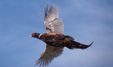
SALEM, Ore.— If you are considering registering for a youth pheasant hunt, it is not too late. More slots have opened for many youth pheasant hunts being held statewide this month after duplicate registrations were removed from the system. "We've heard some parents have been unable to sign up their…

The Columbia Basin Wildlife Areas are a composition of four Oregon Dept. of Fish & Wildlife managed wildlife areas located along the Columbia River in the Columbia Basin. The four wildlife areas (Power City, Irrigon, Coyote Springs, and Willow Creek) are within the Columbia Plateau ecoregion. Management agreements for these areas were initially established between 1971 and 1977 between the department and Federal agencies which own the lands. The Columbia Basin Wildlife Areas, which total approximately 1,885 acres, provides an important landbase for the conservation and recreation of fish and wildlife within a highly privatized and altered landscape and play…
Find maps, boundary descriptions and the percent public land for the Fort Rock Unit.
Find maps, boundary descriptions and the percent public land for the Santiam Unit.
Find maps, boundary descriptions and the percent public land for the Sled Springs Unit.
Find maps, boundary descriptions and the percent public land for the Scappoose Unit.

Find maps, boundary descriptions and the percent public land for the Indigo Unit.
Coquille Valley Wildlife Area was initially established in 2013 with two equally important primary objectives; (1) To protect, enhance, and restore fish and wildlife habitats located on the WA, and (2) to provide a wide variety of wildlife-oriented recreational and educational opportunities to the public.
