
Search myodfw.com
Showing 301 - 320 of 714 results

July and August
Multiple locations
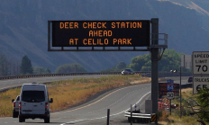
SALEM, Ore.—As 2025 deer and elk hunting seasons begin, ODFW is ramping up its Chronic Wasting Disease (CWD) surveillance statewide. Hunters are encouraged to take advantage of streamlined testing options and reminded that CWD check stations are mandatory to stop at when transporting harvested deer or elk. Sampling is quick…
SALEM, Ore. – Oregon may soon have a new wildlife area in Union County called the Qapqápa Wildlife Area (pronounced cop-COP-a). The property would be owned by the Oregon Department of Fish and Wildlife (ODFW) and co-managed with the Confederated Tribes of the Umatilla Indian Reservation (CTUIR), continuing a decades-long…

Find maps, boundary information and the percent public land in the Upper Deschutes Unit.
Find maps, boundary descriptions and the percent public land for the Imnaha Unit.
Find maps, boundary information and the percent public land in the Applegate Unit.
Find maps, boundary descriptions and percent public land for the Hood Unit.
Find maps, boundary information and the percent public land for the Maupin Unit.
Find maps, boundary information and the percent public land in the Maury Unit.
Find maps, boundary information and the percent public land in the Sixes Unit.
Find maps, boundary descriptions and the percent public land for the Warner Unit.
Find maps, boundary descriptions and the percent public lands in the Ukiah Unit.
Find maps, boundary information and the percent public land in the Ochoco unit.
Find maps, boundary descriptions and the percent public land for the Wenaha Unit.
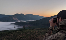
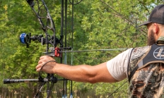
Spring, fall and winter are the seasons when most big game hunters will be in the woods or on the grasslands. Visit e-regulations
