
Search myodfw.com
Showing 761 - 780 of 897 results
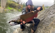
SALEM, Ore. – The Pacific Fishery Management Council (PFMC) met March 4-9 to develop three alternatives for ocean salmon seasons along the coasts of Washington, Oregon, and California. PFMC is hosting a hybrid public meeting March 24 from 7-9 p.m. in Newport to receive input on the proposed salmon management…

Features: Channel catfish are pale bluish-olive above and bluish-white below with a deeply forked tail, dorsal and pectoral spines, and an adipose fin. Like all other catfish, channel catfish have “whiskers” or barbels extending from the chin and upper jaw. Young fish have a varying number of small black spots over much of the body, while older fish may be partially or entirely without spots. Maximum size in Oregon approaches 40 pounds, but most are less than 10 pounds. Habitat: Channel catfish in western Oregon are limited to the Columbia River, lower Willamette River, and a few ponds in the…

SALEM, Ore. – ODFW invites the public to view artwork entered in the annual stamp art contest on Tuesday, Nov. 4 from 12:30-5:00 p.m. at ODFW Headquarters in Salem. The event is free and open to the public. Located at 4034 Fairview Industrial Dr SE, Salem, ODFW Headquarters will host…
The tail is brown dorsally with a white fringe, and white ventrally. In males, antlers with tines typically arise from a single main beam. In winter, the pelage is a dark buffy-gray and consists of relatively long, thick, and somewhat brittle hairs; in summer, the pelage is lighter with more tawny tones and is shorter and thinner. The midline of the dorsum is darker and the fade lighter; in males, the patch between the antlers is darker. Pelage markings include white on the venter, throat, muzzle and lower lip, and around the openings of the metatarsal and interdigital glands; a…

Find maps, boundary descriptions and the percent public land for the Imnaha Unit.
Find maps, boundary descriptions and the percent public land for the Lookout Mountain Unit.
Find maps, boundary information and the percent public land in the Upper Deschutes Unit.


Find maps, boundary information and the percent public land in the Applegate Unit.
Find maps, boundary descriptions and percent public land for the Hood Unit.
Find maps, boundary information and the percent public land for the Maupin Unit.
Find maps, boundary information and the percent public land in the Maury Unit.
Find maps, boundary information and the percent public land in the Sixes Unit.
Find maps, boundary descriptions and the percent public land for the Warner Unit.