Search myodfw.com
Showing 181 - 200 of 1415 results
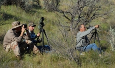
Find maps, boundary descriptions and hunts available in the new Klamath Basin Hunt Area. Download printable PDF map
Find maps, boundary descriptions and hunts available in the new Northeast Hunt Area. Download printable PDF map


The original Riverside Tract is adjacent to the Malheur River near the former railroad community of Riverside. It was purchased from the Blaylock family in 1976 and has been administered by ODFW as Riverside Wildlife Area since that time. The purpose of this initial acquisition was to provide public fishing and hunting access to a previously privately held portion of the Malheur River canyon. In addition, this purchase provided the opportunity for the department to emphasize fish and wildlife habitat management in the river canyon. Additional acres were added to this tract in 1977. In 1972, the department purchased a…
SALEM, Ore. – The Oregon Fish and Wildlife Commission adopted a management plan for the Minam Wildlife Area, approved a land acquisition for Denman Wildlife Area and heard an update on Oregon's Native Seed Strategy. The plan was the result of extensive engagement with the tribes, community partners, and the…
Find maps, boundary descriptions and hunts available in the new Sage Hen Hunt Area. Download printable PDF map
CENTRAL POINT, Ore. – The Rogue-Siskiyou National Forest is temporarily closing the Huckleberry Mountain area in the High Cascades Ranger District Aug. 22-31 for Tribal ceremonial purposes. Rogue Unit general archery hunters should be aware of the closure over the archery opening weekend, Aug. 30-31. For more information on the…

This is a medium-sized bat with large, long ears. It is gray, brown, or black and generally active only after full darkness. Townsend's big-eared bat is very vulnerable to human disturbance, and its numbers are declining. In Oregon, it is classified as a State Sensitive Species. It's also an Oregon Conservation Strategy Species in all ecoregions except Nearshore. Never disturb this bat if you are in a cave. Photo by ©Michael Durham

Find maps, boundary descriptions and hunts available in the new Poverty Basin Hunt Area. Download printable PDF map
Central Point, Ore. – Hunters and recreationists who plan to use the Jackson Cooperative Travel Management Area (TMA) should download the newest version of the georeferenced .pdf map. updated on Oct. 14. There have been major changes this year, so users should double check where they plan to access. These…
SALEM, Ore.—The Commission approved a revised State Wildlife Action Plan (SWAP) today, a plan that serves as a roadmap for protecting Oregon's at-risk species and their habitats. The Plan incorporates the latest available information on species and presents recommended conservation actions to inform and prioritize conservation work for community members…

Find maps, boundary descriptions and hunts available in the new Southeast Hunt Area. Download printable PDF map