

Search myodfw.com
Showing 281 - 300 of 903 results
Landing page
Find maps, boundary descriptions and hunts available in the new Sage Hen Hunt Area. Download printable PDF map
November 15, 2025
Landing page
Find maps, boundary descriptions and hunts available in the new Sage Hen Hunt Area. Download printable PDF map
November 15, 2025
Landing page
Find maps, boundary descriptions and hunts available in the new Crooked River Hunt Area. Download printable PDF map
November 13, 2025
Landing page
Find maps, boundary descriptions and hunts available in the new Devils Garden Hunt Area. Download printable PDF map
November 13, 2025
Landing page
Find maps, boundary descriptions and hunts available in the new Klamath Basin Hunt Area. Download printable PDF map
November 14, 2025
Landing page
Find maps, boundary descriptions and hunts available in the new South Wallowa Hunt Area SW-02. Download printable PDF map
November 15, 2025
Workshop and Events
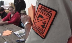
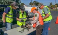
Oregon requires all hunters under the age of 18 to complete a hunter safety education course before hunting in the state. Upon completing the course (and a Field Day for youth), participants will receive a Hunter Safety certification number and card. Adults are also encouraged to take the online course, as it may be required for out of state hunts. Note: Youth under the age of 9 may struggle with the course material and may not have the physical strength needed to safely handle a firearm during a Field Day, particularly during muzzle control, loading, and unloading drills.
Date
Offered Year Round
Location
Statewide
Landing page
Find maps, boundary descriptions and hunts available in the new Devils Garden Hunt Area. Download printable PDF map
November 13, 2025
Landing page
Find maps, boundary descriptions and hunts available in the new Poverty Basin Hunt Area. Download printable PDF map
November 15, 2025
Article
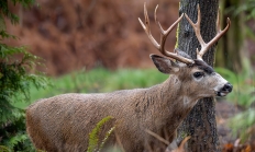
Cougars currently occupy most of the available cougar habitat in the state and are expanding into lower quality habitats that include human habitation. At the same time, urban areas are expanding into cougar habitat due to population growth and development. Follow these tips to stay safe in cougar country.
March 27, 2026

Article
Check out the latest point summary reports for all big game, and use the information to strategize while deciding which controlled hunts to apply for next season. Mark your calendar and apply early, starting December 1st: Apply now for a controlled hunt
September 30, 2025
Species and Subspecies
Pheasants, grouse, quail and turkey are all upland game birds that are chicken-like and ground-dwelling. Wild turkeys are the largest upland game bird in Oregon.

Landing page
Located near the Elkhorn Mountain Range, Elkhorn Wildlife Area is best known for Rocky Mountain elk and mule deer herds that use the area during the winter. To keep deer and elk from feeding on agriculture lands when they come down from snow-covered higher elevations, ODFW operates 10 feeding sites on the area to feed 1,400 elk and 800 deer during the winter months.
March 05, 2018
Article
Due to customer demand for a more modern, easier-to-navigate website, ODFW is introducing MyODFW.com. This new mobile-friendly website was designed with the hunting, fishing and wildlife viewing customer in mind.
September 19, 2017

Article
Chronic Wasting Disease (CWD) is a fatal disease infecting deer, elk, and moose across North America. While CWD has not yet been detected in Oregon, it has been found in three bordering states – Idaho, California, and Washington. We have a chance to manage CWD if both hunters and wildlife managers work together. Get your animals tested and educate yourself and others about CWD. Ways to Get Tested Check Results Sign up for Updates
November 20, 2025
Zones or Areas
The transition from forested foothills of Mt. Hood to the beginnings of the Columbia Basin offers big game hunters an array of opportunities. The challenge can be finding public land or getting permission to hunt on private land.
Zones or Areas
This vast area covers the Columbia Basin through the Blue, Wallowa and Elkhorn mountains to Hells Canyon. Some of Oregon's most prized big game hunts are managed in this area.

Zones or Areas
Southeast Oregon, with its ponderosa pine forests, sage steppe expanses and aspen pocked mountains, is a very popular area to hunt mule deer, elk and pronghorn antelope.

Zones or Areas
This area extends from the eastern flanks of the Cascade Range through the Ochoco Mountains to the beginning of the Great Basin, making it a great place to explore.
