
Search myodfw.com
Showing 301 - 320 of 903 results
Features: Overall, medium-gray with a white underside. Gray, bushy tail has a white "halo." Habitat: It is commonly associated with mixed forest communities in central Wasco, Jefferson, Deschutes, and Klamath counties west, except for unforested portions of the Willamette Valley, to central Washington, Benton, Lane, Douglas, Coos, and Curry counties. It is active at all seasons and exhibits diurnal activity almost exclusively. Techniques: Most hunters use a small caliber rifle, and aim for the head to avoid ruining the meat.


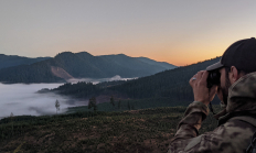
Features: Oregon is home to an estimated 25,000-30,000 black bears, which is North America’s most common bear species. They are the only type of bear found in Oregon. Despite their name, black bears are often brown in color. Habitat: Black bears are found statewide, with concentrations in the Coast and Cascade ranges and the Blue Mountains. Techniques: Oregon offers a controlled spring season (apply by Feb. 10) and a general fall season. Glassing open areas where bears are feeding on grass and shrubs works early spring season. Later in the season, some hunters turn to predator calls. Most fall bears…


The Columbia Basin Wildlife Areas are a composition of four Oregon Department of Fish and Wildlife (department) managed wildlife areas located along the Columbia River, in the Columbia Basin. The four wildlife areas (Power City, Irrigon, Coyote Springs and Willow Creek) are within the Columbia Plateau ecoregion. Management agreements for these areas were initially established between 1971 and 1977 between the department and Federal agencies which own the lands. The Columbia Basin Wildlife Areas, which total approximately 1,885 acres, provide an important landbase for the conservation and recreation of fish and wildlife within a highly privatized and altered landscape and…
The FRWA was created by a licensing agreement signed in 1957 and modified in 1982 and 2008, between the US Army Corps of Engineers and the Oregon Game Commission. This agreement authorized the state to develop, conserve, and manage all wildlife resources on 5,261 acres of land and water within the Fern Ridge Project. ODFW also acquired the 309 acre Coyote Creek South and 224 acre Coyote Creek Northeast units in 2013 and 2015, respectively. The wildlife area now totals 5,794 acres.
July 18, 2026
Redmond Rod and Gun Club, 9020 S Hwy Redmond, OR 97756
SALEM, Ore.—With the May 15 deadline approaching, ODFW is reminding hunters to apply early for 2026 controlled deer hunts and to carefully review changes to Eastern Oregon deer hunts. With the transition from Wildlife Management Units (WMUs) to Deer Hunt Areas in eastern Oregon, hunters who wait until the last…
This popular upland game bird is the largest of Oregon's three forest grouse. It is well known for the distinctive hooting call emitted by courting males in the spring. This call is accompanied by an extravagant courtship display involving exposure of blood-engorged, featherless shoulder spots and eye combs, which are reddish to orange. It is a common resident in coniferous forests. Hear the call of the dusky grouse Photo by Jim Dollar, Flickr

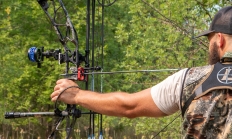
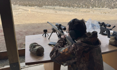
This hands-on course is designed for adults eager to enter (or advance in) big game hunting with a modern, scoped bolt-action rifle—the most popular and precise choice for ethical big game pursuits.
Check back weekly for additional events COMING SOON.
Multiple locations
Ruffed grouse are named for a series of black iridescent feathers on the sides of the neck called the ruff, which is erected by males to form an ring around the neck during courtship displays. This forest-dwelling species, favored by upland game-bird hunters, is well known for the drumming of the males during courtship displays in the spring. It is a common resident throughout most forested regions of the state. It occupies most forests at low to moderate elevations east of the Cascade crest, primarily the east slope of the Cascades from Ft. Klamath and upper Klamath Lake and Blue…

California quail are the most widely distributed upland game birds in Oregon. Most easily recognized by the comma-shaped, black, plume, or "topknot," which bends forward and is larger on the male. It has been a resident statewide since the early 1900s, except for most forests of the north Coast Range and west Cascades; it is generally absent along the coast north of Coos Bay. California quail is also absent from high-elevation areas of the east Cascade range. They are common residents in rural and even some suburban areas, particularly in eastern Oregon where many coveys gather at feeding stations during…

Summer Lake Wildlife Area was established in 1944, with primary objectives of protecting and improving waterfowl habitat and providing a public hunting area. It is now a popular destination for hunting, wildlife viewing and environmental education due to its geographic setting, the abundance of wildlife present and species diversity.

Following droughts in the 1930s that affected most of North America, major conservation efforts, by both private and governmental entities, were enacted to reverse trends of degrading and disappearing wetlands. During this time period there was a major creation and expansion of federal wildlife refuges and state wildlife areas. As the concept of waterfowl flyway management was endorsed and developed, wildlife areas were acquired and managed as part of a larger plan focused on migratory waterfowl needs. LMWA was one of several wetland-focused wildlife areas established in Oregon. Ladd Marsh Wildlife Area was established in 1949, with primary objectives of…