
Search myodfw.com
Showing 441 - 460 of 1282 results

SALEM, Ore. – The Oregon Conservation and Recreation Fund (OCRF) Advisory Committee is excited to announce that its next grant cycle will begin accepting applications on Monday, Dec. 15, with the application window open through Feb. 9, 2026. Visit the Online Application System and enter access code "OCRF" to begin…
SALEM, Ore.–The Fish and Wildlife Commission meets Sept. 11 and 12 in Ontario for a field tour on Thursday and a regular meeting on Friday. See agenda here. The meeting will also be livestreamed from the Commission page. To testify on an agenda item virtually, register on the agenda page…
Updated statement Friday, Nov. 7, 2025 SALEM, Ore. – A coyote was captured and humanely killed on Oct. 31 and confirmed to be the individual animal that bit a 9-year-old child in the Alameda neighborhood on Oct. 23. ODFW worked with partners at the city, state, and federal levels to…
This vast area covers the Columbia Basin through the Blue, Wallowa and Elkhorn mountains to the Snake River.
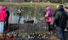
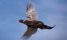
SALEM, Ore.— If you are considering registering for a youth pheasant hunt, it is not too late. More slots have opened for many youth pheasant hunts being held statewide this month after duplicate registrations were removed from the system. "We've heard some parents have been unable to sign up their…
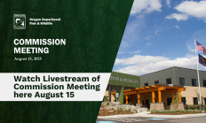
SALEM, Ore.—Oregon's Fish and Wildlife Commission will meet Friday, Aug. 15 in Salem at ODFW Headquarters, 4034 Fairview Industrial Drive SE. The meeting will be livestreamed from the Commission page. See the agenda here. (Note that Commission materials have moved to myodfw.com while ODFW's older website odfw.com is transitioned to…


Hunting opportunities abound in the densely forested southwest corner of Oregon. From the beautiful, ragged coastline through the Siskiyou Mountains to Crater Lake National Park, there is something for every game bird hunter.
SALEM, Ore. – Organizations and partners interested in funding conservation, outdoor access, and recreation projects in Oregon are encouraged to apply soon, as the Oregon Conservation and Recreation Fund (OCRF) grant application window is open now but closes Monday, Feb. 9, 2026. The OCRF Advisory Committee began accepting applications on…
Find maps, unit descriptions and the percent public lands in the Starkey Unit.
Oregon's recreational fisheries for Pacific halibut and bottomfish are constrained by bycatch of yelloweye rockfish, an overfished species. Many of the regulations on these fisheries exist to keep bycatch of yelloweye rockfish within sustainable limits, in order to help the stock recover (for example, depth restrictions in the bottomfish fishery, and no lingcod during offshore long-leader trips). ODFW encourages anglers to reduce impacts by using descending devices to release yelloweye rockfish, and better yet, to avoid areas where they might be caught.

Find maps, boundary descriptions and the percent public land for the Silvies Unit.


Three Mile Falls Dam is located at river mile three on the Umatilla River. The dam was constructed in the early 1900s and serves as an irrigation dam that is a complete barrier to fish migrating upstream. In order to successfully migrate past the dam, all adult salmon and steelhead must use the fish passage facility located on the east side of the dam. The fish facility consists of a fish ladder, viewing window, fish trap and holding pond. Every adult salmon and steelhead heading upstream is counted at this facility using a combination of trapping and video tape enumeration…