
Search myodfw.com
Showing 221 - 240 of 396 results
Find maps, boundary descriptions and hunts available in the new Painted Hills Hunt Area. Download printable PDF map
Find maps, boundary descriptions and hunts available in the new Sage Hen Hunt Area. Download printable PDF map
Find maps, boundary descriptions and hunts available in the new Aldrich Hunt Area. Download printable PDF map
Find maps, boundary descriptions and hunts available in the new Deschutes Hunt Area. Download printable PDF map
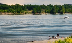
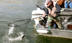
NEWPORT, Ore. – Ocean sport salmon fishing closes at 12:01 a.m., Tuesday, Aug. 19 in the Columbia River Subarea (Leadbetter Pt., WA to Cape Falcon, OR) and possession of salmon on board a vessel is prohibited. Fishing is allowed on Monday and is closed Tuesday. Projected harvest of marked (fin-clipped)…
Find maps, boundary descriptions and hunts available in the new Elkhorn Hunt Area. Download printable PDF map
Find maps, boundary descriptions and hunts available in the Juntura Hunt Area. Download printable PDF map
Find maps, boundary descriptions and hunts available in the new Sage Hen Hunt Area. Download printable PDF map

Establishment of the Bridge Creek Wildlife Area initially started in 1961 when a parcel of land was purchased from the Frank Hilbert estate. After the initial purchase, several private holdings were acquired to consolidate the land under department ownership. The last parcel was purchased from the Colvin Cattle Company in 1975. The primary purpose of the wildlife area is to maintain and protect a key historic winter range for Rocky Mountain elk ( Cervus elaphus nelsoni).
Coquille Valley Wildlife Area was initially established in 2013 with two equally important primary objectives; (1) To protect, enhance, and restore fish and wildlife habitats located on the WA, and (2) to provide a wide variety of wildlife-oriented recreational and educational opportunities to the public.
Find maps, boundary descriptions and hunts available in the new Crooked River Hunt Area. Download printable PDF map
White River Wildlife Area was established in 1953. Located along the east slope of the Cascade Mountains in the north central part of Oregon, the wildlife area encompasses 29,480 acres. An additional 1,280 acres of land owned by the Bureau of Land Management (BLM) is managed by the ODFW bringing the total acres managed by the department to 30,760. The primary purpose of White River Wildlife Area is to provide winter range habitat for black-tailed deer and Rocky Mountain elk and to minimize big game damage to adjacent private agricultural lands.
Find maps, boundary descriptions and hunts available in the new Devils Garden Hunt Area. Download printable PDF map
Find maps, boundary descriptions and hunts available in the new Klamath Basin Hunt Area. Download printable PDF map
Find maps, boundary descriptions and hunts available in the new South Wallowa Hunt Area SW-02. Download printable PDF map
Jewell Meadows Wildlife Area is located in the Oregon Coast Range Mountains, in the northwestern part of the state. The wildlife area was established in 1969, with an initial purchase of 183 acres. It now encompasses 1,114 acres. The wildlife area’s purpose is to protect and enhance habitat to benefit native wildlife species, to reduce wildlife damage to adjacent properties, and to provide the public with an opportunity to observe wildlife in a natural setting.
The development of the WWA began in 1953 with the acquisition of five parcels of land consisting of 4,400 acres. The Department continued to purchase additional lands, acquiring 1,670 acres in 1954 and another 760 acres in 1955. From 1961 to the present the department has purchased or received another 4,219 acres. The wildlife area currently consists of 12,419 acres owned by the department. In addition, the department, through agreements with the Bureau of Land Management (BLM), manage 1,329 acres within or adjacent to the wildlife area. The WWA was established in response to continuing complaints from landowners concerned with…