
Search myodfw.com
Showing 301 - 320 of 1282 results
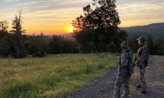
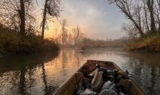
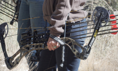
Hunter's Guide Hunter's Resources Hunter's Technique Hunter's Bounty
Various seasons
Online Learning

The original portion of Fall River Hatchery construction was completed in 1929. Many improvements have been made since original construction. In 1952 the ten raceways were completed. The hatchery produces legal and trophy sized rainbow trout, and provides rainbow, brook and cutthroat trout fingerlings for air stocking programs throughout the state. The facility traps and spawns brown trout at a remote site.
Roaring River Hatchery was constructed in 1924. Many improvements have been made to the hatchery since the original construction. In 1987 and 1996 new raceway ponds were constructed to replace the original raceways. The hatchery is a mixed-stock facility, producing both anadromous fish and resident trout. The hatchery is used for rearing summer and winter steelhead from fingerling to smolt. The rainbow trout program involves broodstock maintenance, spawning, egg incubation and rearing.
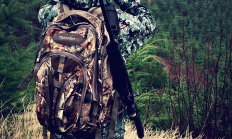
Begin your hunting journey or as an experienced hunter seek to refine your skills. The ODFW Hunter Recruitment Program offers resources and training to help you learn to hunt successfully. Connect with Oregon's outdoor traditions, enhance your skills, and contribute to a culture of safe, ethical, and conservation-minded hunting and shooting sports. More information about ODFW Hunter Recruitment Program Classes and workshops are designed for adults 18+.
Year round opportunities
Statewide
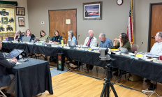
SALEM, Ore. — ODFW's Fish Restoration and Enhancement Board will meet in person on Thursday, March 5 from 8 a.m. - 5 p.m. in the classroom at ODFW Headquarters, 4034 Fairview Industrial Dr. SE. A virtual option is also available. The public can attend in person or virtually on Teams…
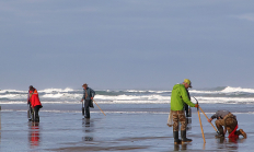
ASTORIA, Ore – The annual conservation closure of razor clamming on Clatsop beaches begins 12:01 a.m. July 15. The Oregon Department of Fish and Wildlife encourages clammers to take advantage of the low tide series that begins July 8. However, ODFW reminds clammers that although the low tide series goes…
In Oregon, the nutria is considered an invasive species. The nutria is a large rat-like semiaquatic rodent. The species has a hunched body; a round, nearly hairless tail; a valvular mouth and nose; and pentadactyl feet with naked soles. The toes of the hind feet, except for the hallux, are included in a web. As an adaption to the aquatic environment, the eyes, nostrils, and small ears are set high on the sides. The pelage consists of long, course guard hairs and soft, dense underfur. Overall, the color usually ranges from dark brown to yellow-brown. The muzzle is frosted with…

Bats are important pollinators and the only flying mammals; they use sound to locate their prey, and they live a long time. Oregon has 15 species of bats, and eight of those are Oregon Conservation Strategy Species. Strategy Species are those having small or declining populations, are at-risk, and/or of management concern. Some of Oregon's species migrate south in winter while some remain here and hibernate. Bats have echolocation which allows them to make high-pitched sounds then listen to the echo of those sounds to locate where objects are. Echolocation helps them find even the smallest insect.

The major portion of Elk River Hatchery construction was completed in 1968. In 1971 the hatchery completed final construction on an intake and ten new ponds. The purpose of the facility is to supplement natural production of fall Chinook in the Elk and Chetco Rivers and winter steelhead in the Chetco River. The facility is used to collect Elk River fall Chinook, to incubate eggs and rear both natural and hatchery fall Chinook and winter steelhead.
SALEM, Ore. – Oregon's Fish Screening and Fish Passage Task Forces will meet Wednesday, May 6 at 8:00 a.m. The meeting is open to the public and will be held in person at The Dalles Screen Shop at 3561 Klindt Dr, The Dalles and virtually through Teams. The meeting agenda…
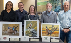
SALEM, Ore. – The winning artwork has been selected for the 2026 Oregon Waterfowl, Upland Game Bird, and Habitat Conservation Stamp Art Contests. In the Waterfowl Stamp category, first place went to Richard Clifton of Milford, Del., for his artwork featuring a blue-winged teal. For the Upland Game Bird category…
The most common whale off the Oregon coast is the gray whale. In addition to the approximately 200 resident gray whales that live nearly year-round off Oregon, a winter and spring migration brings about 18,000 more past our coast. Gray whales are baleen whales (mysticetes). They grow to 50 feet in length and will weigh up to 80,000 pounds; adult females are larger than males, which is common in all baleen whales. They do not have a dorsal fin on their back but instead have a series of knuckles. These whales are mottled gray and are covered with barnacles and…
