
Search myodfw.com
Showing 321 - 340 of 394 results
Find maps, boundary descriptions and the percent public land for the Minam Unit.
Find maps, boundary descriptions and percent public land for the Murderers Creek Unit.
Find maps, boundary descriptions and the percent public land for the Silvies Unit.
Find maps, boundary descriptions and the percent public land for the Steens Mountain Unit.

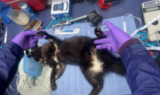
SALEM, Ore. – People across Oregon are being urged to avoid contact with sick or dead birds as highly pathogenic avian influenza (HPAI) continues to impact wild and domestic bird populations across the state. There is currently no effective treatment for wild and domestic birds, and the virus can spread…

Find maps, boundary descriptions and the percent public land for the Saddle Mountain Unit.

Cole Rivers Hatchery is the largest producer of hatchery fish on the coast of Oregon. Almost all of the fish production at Cole Rivers is done to mitigate for the fish production that was lost when miles of high quality fish habitat was blocked by Applegate Dam (Applegate Reservoir) and William Jess Dam (Lost Creek Reservoir). Visit Cole Rivers Hatchery
Updated December 31, 2025 Subscribe for updates Starting Jan. 1, 2026, an Ocean Endorsement is needed for most recreational anglers fishing in the ocean. Check the Ocean Endorsement page for more information. Ocean Endorsement


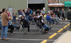
ODFW Director Debbie Colbert (at podium) and Coquille Tribe Chairwoman Brenda Meade (to the right in black jacket) on July 31, 2025 in Bandon, Ore. to announce a major step forward in their combined management effort on salmon recovery in the Coquille River. The first fall Chinook fishery since 2021…
Find maps, boundary descriptions and the percent public land for the Fort Rock Unit.
Find maps, boundary descriptions and the percent public land for the Santiam Unit.

Find maps, boundary descriptions and the percent public land for the Sled Springs Unit.
Find maps, boundary descriptions and the percent public land for the Trask Unit.