Search myodfw.com
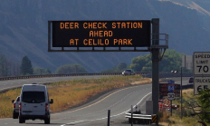
SALEM, Ore.—As 2025 deer and elk hunting seasons begin, ODFW is ramping up its Chronic Wasting Disease (CWD) surveillance statewide. Hunters are encouraged to take advantage of streamlined testing options and reminded that CWD check stations are mandatory to stop at when transporting harvested deer or elk. Sampling is quick…
NW WILDLIFE VIEWING January 15, 2026 Tillamook County Birds Large numbers of waterfowl arrive before November and will likely spend the rest of the winter here. They will raft up out in the middle of most local estuaries on calm days but will move around with the incoming tide and on windy days. Many species of diving ducks can be seen on area lakes and bays. Likewise, many migrating geese are beginning to arrive and are using area fields, along with many egrets, herons and wintering raptors. Pastures and fields are heavily used by a variety of waterfowl when flooded…
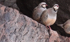
Pheasants, grouse, quail and turkey are all upland game birds that are chicken-like and ground-dwelling. Wild turkeys are the largest upland game bird in Oregon.
Round Butte Hatchery was constructed in 1972 to mitigate for the fishery losses caused by Pelton/Round Butte (PRB) Hydroelectric Complex. Round Butte and its satellite, Pelton Ladder, are used for adult collection, egg incubation and rearing of spring Chinook, summer steelhead, and sockeye salmon.
Find maps, boundary information and the percent public land in the Upper Deschutes Unit.
Find maps, boundary descriptions and the percent public land for the Imnaha Unit.
Find maps, boundary descriptions and the percent public land for the McKenzie Unit.
Find maps, boundary descriptions and the percent public land for the Owyhee Unit.
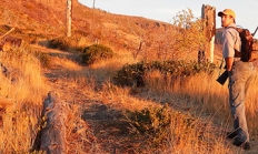
Spring, fall and winter are the seasons when most big game hunters will be in the woods or on the grasslands. Visit e-regulations
Find maps, boundary descriptions and percent public land for the Hood Unit.
Find maps, boundary information and the percent public land in the Sixes Unit.
Find maps, boundary information and the percent public land for the Maupin Unit.
Find maps, boundary information and the percent public land in the Maury Unit.
Find maps, boundary descriptions and the percent public land for the Warner Unit.
Find maps, boundary information and the percent public land in the Applegate Unit.
Find maps, boundary information and the percent public land in the Ochoco unit.

