

Search myodfw.com
Showing 141 - 160 of 231 results
Zones or Areas
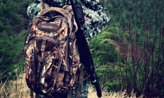
Densely forested hillsides from the coast through the Siskiyou Mountains to the Cascade Range offer excellent habitat for a myriad of big game species.
Landing page
Find maps, boundary descriptions and the percent public land for the Beatys Butte Unit.
September 05, 2017
Landing page
Find maps, boundary descriptions and the percent public land for the Malheur River Unit.
September 05, 2017
Recreation Report
SOUTH CENTRAL BIG GAME HUNTING June 9, 2026 Currently open Cougar ( check current harvest numbers), Coyote Announcements and resources View the Big Game raffle and auction hunt results along with the 2026 seed number drawing results. Big game harvest statistics - You'll find links to population, harvest and point summary reports that can help you decide what hunts to apply for this season. Please report elk with hoof disease - If you see elk showing signs of elk hoof disease, including lame or limping elk or elk with damaged, injured, missing or deformed hooves, please report it using this…
September 21, 2017
Article
Oregon offers some great opportunities for the first-time hunter -- from deer and elk, to geese and ducks, to chukar and pheasants. Here are a few pointers to help you get started. Hunter's Guide Hunter's Resources Hunter's Technique Hunter's Bounty
October 30, 2025
Article
Cougar season and hunting information, including information about cougar conflict target areas. Resuming in 2022, successful cougar hunters must appear in-person at an ODFW office to check in their cougar.

Species and Subspecies
Features: Oregon is home to more than 6,000 cougars, or mountain lions. Cougars are the largest members of the cat family found in the state and tend to be solitary, except for females raising young. Males in particular are very territorial. Habitat: Cougars are throughout Oregon, with concentrations in the Cascade Range and Blue Mountains. Lately, more cougars are being seen in northwest Oregon including the suburbs of Portland. Techniques: Hunting is open statewide under a general season all year, or until zone quotas are met. Most cougars in Oregon are taken while hunters are out pursuing other species like…


Species and Subspecies
Features: Oregon is home to an estimated 25,000-30,000 black bears, which is North America’s most common bear species. They are the only type of bear found in Oregon. Despite their name, black bears are often brown in color. Habitat: Black bears are found statewide, with concentrations in the Coast and Cascade ranges and the Blue Mountains. Techniques: Oregon offers a controlled spring season (apply by Feb. 10) and a general fall season. Glassing open areas where bears are feeding on grass and shrubs works early spring season. Later in the season, some hunters turn to predator calls. Most fall bears…

Landing page
Find maps, boundary descriptions and the percent public land for the Juniper Unit.
September 05, 2017
Landing page
Find maps, boundary information and the percent public land in the Paulina Unit.
September 05, 2017
Landing page
Find maps, boundary descriptions and the percent public land for the Scappoose Unit.
September 05, 2017
Landing page
Find maps, unit descriptions and the percent public lands in the Starkey Unit.
September 05, 2017
Landing page
Find maps, boundary descriptions and the percent public land for the Stott Mountain Unit.
September 05, 2017
Landing page
Find maps, boundary descriptions and the percent public land for the Wagontire Unit.
September 05, 2017
Recreation Report
SW WILDLIFE VIEWING June 18, 2026 Coos and Curry counties Coquille Valley Wildlife Area (CVWA) Coquille Valley Wildlife Area (CVWA) in Coos County is open to public access. Permits for access are required and are available, free of charge, at the kiosk located in the parking lot along North Bank Road. You must access CVWA through this point. Please fill out the upper half ("A" half) of the permit and deposit it in the slot located on the post of the kiosk. Sign and carry the lower half ("B" half) with you while you enjoy CVWA. At the end of…
September 05, 2017
Article
ODFW wants to make sure our uniformed service members are given the opportunity to participate in the outdoor recreation Oregon has to offer.
April 15, 2026
Landing page
Find maps, boundary descriptions and the percent public land for the Beulah Unit.
September 05, 2017
Landing page
Find maps, boundary descriptions and the percent public land for the Minam Unit.
September 05, 2017
Landing page
Find maps, boundary descriptions and percent public land for the Murderers Creek Unit.
September 05, 2017