Search myodfw.com
Showing 1021 - 1040 of 1635 results
The Eastern gray squirrel is the smallest member of the genus in Oregon. This squirrel was introduced into Oregon and can now be found in Salem, Portland, Milwaukie, and Vale. All populations in Oregon have been found in urban areas. This squirrel is active throughout the year, activity restricted to daylight hours. Photo from Washington Fish and Wildlife

The Western gray squirrel is the largest tree squirrel in the state. It occurs from central Wasco, Jefferson, Deschutes, and Klamath counties west, except for unforested portions of the Willamette Valley, to central Washington, Benton, Lane, Douglas, Coos, and Curry counties. It is commonly associated with mixed forest communities. These squirrels are wary and secretive, but curious; they examine new objects placed in their environment but, once captured, they often avoid live traps. Western gray squirrels are an Oregon Conservation Strategy Species in the Willamette Valley ecoregion. Photo from ODFW

The Eastern fox squirrel is among the larger of the tree squirrels in Oregon. Its body is the typical squirrel shape. The ears are short, rounded, and without tufts. The tail is flattened and somewhat fluffy. In Oregon, it has been found in Multnomah, Washington, Marion, Lane, Union, Clackamas, Yamhill and Baker counties, all occurring in urban areas or in association with nut orchards. The Eastern fox squirrel is active throughout the year during daylight with its greatest activity in the early morning and late afternoon. During autumn, they are exceptionally active on the ground, scatter-hoarding nuts and acorns as…

The Douglas' squirrel is one of the smaller tree squirrels in Oregon. The color and markings of this squirrel differ individually, geographically and seasonally, appearing a dusky olive to brownish gray with an indistinct band of reddish brown with a blackish band along the flanks. In Oregon, it occurs in coniferous forests from the Pacific coast to as far east as western Baker County. Douglas' squirrels are active during the daylight hours year-round, although they may remain in their nests or tree dens for a day or two during inclement weather. Photo by Kathy Munsel, ODFW
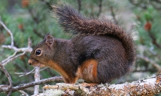
The red squirrel is also a small tree squirrel, only slightly larger than the Douglas' squirrel. They occur in the montane forested portions of Wallowa, Union, Umatilla, Morrow, Malheur and Baker counties. It is a largely arboreal, forest-dwelling species and although often occupying areas vegetated by other conifers, it is associated most frequently with lodgepole pine. Activity patterns of red squirrels are similar to those of Douglas' squirrels. Much activity is directed toward foraging, gathering and catching cones, feeding, and resting. Photo by Shawn Nystrand, Flickr
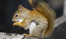
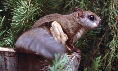
The Northern flying squirrel is the smallest arboreal squirrel in Oregon. It is typically squirrel-like except that the fore- and hind legs are connected by a furred patagium that extends from the ankle to the wrist. It is lead colored with buffy brown to brown tips. It occurs in forested areas west of the Cascade Range and eastward to near Lakeview, Lake County and Paulina Lake, Deschutes County. The species also occurs in the Blue, Ochoco, and Wallowa mountains. Northern flying squirrels are mostly nocturnal although individuals may be observed abroad during light hours on rare occasions. They are usually…
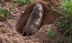
Oregon has five species of pocket gophers that are specially equipped for digging and tunneling. They have large-clawed front paws with small eyes and ears. Sensitive whiskers help them navigate underground.
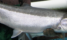
The Sherars Falls Adult Salmon and Steelhead Trap is located at river mile 43 on Oregon's Deschutes River. The trap captures an unknown proportion of adult fall Chinook salmon and summer steelhead that are passing over Sherars Falls. Visit Lower Deschutes Wildlife Area
Oregon's 33 hatcheries produce about 40 million fish annually and you can visit them. They offer the chance to see fish – from eggs to brooders – and an opportunity to learn how they are raised. Oregon's hatcheries are important for anglers and the public because they directly provide fish for angling, help rebuild native fish populations, and offer educational programs. They are also vital to supporting the cultural heritage of Tribes. Hatcheries offer great wildlife viewing, interpretive displays and some provide boating and angling access. Did you know that ODFW rears 10 species of fish including steelhead/rainbow trout, brook…
Find the latest fish counts across the state.
SALEM, Ore. – The Oregon Conservation and Recreation Advisory Committee will meet on Tuesday, October 7, from 1:00 p.m. to 4:00 p.m. The committee will be discussing future grant offerings and strategic communications planning. For more information including an agenda visit: https://www.dfw.state.or.us/conservationstrategy/OCRF/meetings.html The Oregon Conservation and Recreation Fund (OCRF) is…
SALEM, Ore. – ODFW invites the public to view artwork entered in the annual stamp art contest on Tuesday, Nov. 4 from 12:30-5:00 p.m. at ODFW Headquarters in Salem. The event is free and open to the public. Located at 4034 Fairview Industrial Dr SE, Salem, ODFW Headquarters will host…
SALEM, Ore.–The Fish and Wildlife Commission will meet virtually on Friday, Oct. 10 from 8:30 a.m.-noon for a training related to cultural resources, tribal sovereignty, and tribal treaty rights. The meeting will be livestreamed from the Commission page and via ODFW's YouTube channel. Invited speakers will share information with the…

NEWPORT, Ore. – New research from Oregon's south coast highlights the positive economic impact of science and tourism within Redfish Rocks Marine Reserve. The study quantifies the number of jobs supported and income generated by these activities, providing important data for the local Port Orford community, policymakers, conservation practitioners, and…
SALEM, Ore. – Anglers will have additional chances to fish for wild coho this November as ODFW announces extended fishing opportunities in the Siletz, Yaquina, and Alsea river basins. At the request of the Oregon Fish and Wildlife Commission, ODFW staff evaluated the potential for additional fishing days beyond the…

SALEM, Ore. - Oregon's Fish Passage Task Force will meet Thursday, October 16 from 8:00 a.m. to 12:30 p.m. at the Red Lion, 1313 N Bayshore Dr, Coos Bay. The meeting will be open to the public. Members of the public who are interested in the meeting are encouraged to…

A black bear tried its best to get into a Neskowin homeowner's bear resistant trash can. The homeowner then built a small shed to enclose the trash can. The persistent bear left its prints and claw marks on the shed but did not succeed in breaking into it. This resident…
