Search myodfw.com
Showing 781 - 800 of 897 results
Prioritize what you want out of your hunt Controlled Hunt Application Worksheet Steps on how to apply for a controlled hunt

Find maps, boundary information and the percent public land in the Evans Creek Unit.
Find maps, boundary descriptions and the percent public land for the Mt. Emily Unit.
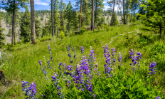
Find maps, boundary information and the percent public land in the Ochoco unit.
Find maps, boundary information and the percent public land in the Powers Unit.
Find maps, boundary information and the percent public land in the Tioga Unit.
Find maps, boundary descriptions and the percent public land for the Wenaha Unit.
The northwest zone provides many opportunities for crabbing and clamming. This zone encompasses Clatsop beaches, Nehalem Bay, Tillamook Bay, Netarts Bay, Nestucca Bay, Siletz Bay, Yaquina Bay, Alsea Bay and Siuslaw River.


Find maps, boundary descriptions and the percent public lands for the Desolation Unit.
Find maps as well as boundary and percent public land for the Grizzly Unit.
Find maps, boundary descriptions and the percent public land for the Siuslaw Unit.
Find maps, boundary descriptions and the percent public land for the Snake River Unit.
Find maps, boundary descriptions and the percent public land for the Walla Walla Unit.

SALEM, Ore. – Oregon may soon have a new wildlife area in Union County called the Qapqápa Wildlife Area (pronounced cop-COP-a). The property would be owned by the Oregon Department of Fish and Wildlife (ODFW) and co-managed with the Confederated Tribes of the Umatilla Indian Reservation (CTUIR), continuing a decades-long…