Search myodfw.com
Showing 781 - 800 of 1635 results
Western pond turtles prefer marshes, streams, rivers, ponds and lakes. They need sparse vegetation nearby for digging nests and like to bask on logs. Population declines are due to habitat loss, degradation of nesting areas by invasive plants, competition from non-native turtles and disease. Predators include raccoons and invasive bullfrogs and fish. Western pond turtles are Oregon Conservation Strategy Species in the Coast Range, East and West Cascades, Klamath Mountains and Willamette Valley ecoregions. Photo by Simon Wray, ODFW

Sea turtles are federally protected under the Endangered Species Act of 1973. NOAA Fisheries is responsible for conservation and recovery of sea turtles in the marine environment, while the U.S. Fish and Wildlife Service is lead on conservation and recovery of sea turtles on nesting beaches.
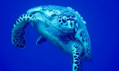
Named for their relatively large head, adult loggerhead turtles can weigh 250 pounds and be three feet in length. Photo from naturalhistoryman, Flickr
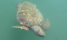
The largest of hard-shelled sea turtles, the green turtle weighs 300 to 350 pounds as an adult, and feeds primarily on sea grasses and algae. Strictly herbivores, green sea turtles are named for their greenish-colored fat. Photo by Dave Budeau, ODFW
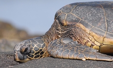
Proposed critical habitat for this endangered species includes Oregon waters. Photo by Alistair Rae, Flickr
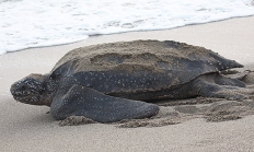
Lizards are more like ancient reptiles than either snakes or turtles. There are more than 2,500 species of lizards known in the world and they range from legless, snake-like varieties to the better known, four-legged type with five toes on each foot and scaly skin. Most lizards lay eggs but some give birth to live young. Most eat insects and small animals; some eat plants. Many lizards are very fast and most can swim. Some can even "swim" through sand, just below the surface. Lizards don't like to be caught and several species will take some pretty drastic steps to…
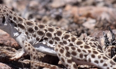
This lizard prefers humid areas, such as the edges of meadows in coniferous forests, and is also found in riparian zones. This is the only lizard found in the cool coastal forests of northern Oregon. The Northern alligator lizard eats small invertebrates (termites, beetles, ticks, spiders, millipedes, and snails), and occasionally takes small birds, mammals, and other lizards. Photo by Simon Wray

The Southern alligator lizard is found in a variety of habitats from grassland and chaparral to oak woodlands and edges of open coniferous forests, as well as riparian zones and moist canyon bottoms. It requires thickets, brush heaps, downed logs, or rock piles for cover. This carnivorous lizard feeds primarily on small invertebrates (slugs, spiders, centipedes, scorpions, beetles, grasshoppers, and crickets), but also is known to feed on bird eggs, nestlings, other lizards, and small mammals. Photo by Alan Harper, Creative Commons

This lizard is found in a variety of desert shrub vegetation types, but is most dependent on the presence of rock outcrops, boulders, or talus slopes. The Mojave black-collared lizard is an aggressive carnivore that eats a variety of other reptiles and large insects, such as crickets and grasshoppers, as well as some plant material. Photo by Belinda Mo, Flickr
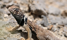
These lizards are found in open desert shrublands, particularly where islands of sand have accumulated around shrubs and are absent where a dense grass understory would inhibit their ability to run. The Long-nosed leopard lizard eats large insects, such as grasshoppers, crickets, and beetles, and also takes small vertebrates, including pocket mice, side-blotched lizards, whiptails, and Western fence lizards. Some plant material (flowers, berries) is eaten when available. Photo by Charlotte Ganskopp

The pygmy short-horned lizard occurs in sagebrush deserts, juniper woodlands, and open coniferous forests. It prefers open areas with sandy soils, but is also found on rocky soil. Ants make up a large part of the diet, but beetles, caterpillars, spiders, and sowbugs are also eaten. This lizard burrows into the soil when inactive. Photo by Dave Budeau, ODFW
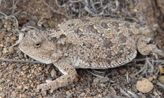
The desert horned lizard is found in flat or gently rolling deserts covered with sagebrush or salt-desert shrub. It prefers areas with scattered bushes and loose, sandy soil, but sometimes occurs in rocky areas or on hardpan. Primary foods are ants and beetles. It also feeds on insect larvae, spiders, crickets, flies, and small grasshoppers. Photo by Kerry Matz, Flickr
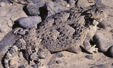
As their common name implies, these lizards are found in sagebrush habitats, but also occur in chaparral, juniper woodlands, and coniferous forests. They require well-illuminated open ground near cover and are primarily ground dwellers. They eat a variety of small invertebrates, including crickets, beetles, flies, ants, wasps, bees, mites, ticks, and spiders. Also called the Northern sagebrush lizard, it is an Oregon Conservation Strategy Species in the Columbia Plateau ecoregion. Photo by ©Keith Kohl, ODFW

The Western fence lizard occupies a wide range of habitats, from desert canyons and grasslands to coniferous forests. It requires vertical structure in its habitat, such as rock piles or logs. It is absent from dense, humid forests and flat desert valleys. This lizard is insectivorous, and feeds on crickets, grasshoppers, beetles, ants , wasps, leafhoppers, and aphids. Some spiders are taken as well. Photo from ODFW

The side-blotched lizard is found in sagebrush, juniper, and shadscale habitats. It is often found on sandy bottoms of washes or canyons, especially in the presence of scattered rocks. This small lizard feeds mostly on smaller invertebrates such as spiders, mites, ticks, sowbugs, beetles, flies, ants, and small grasshoppers. Photo by J. Maughn, Flickr
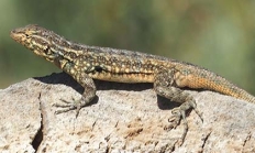
The Western skink is found in moist places such as under rocks or logs in a variety of habitats from grassland and chaparral to desert scrub, juniper woodlands, and coniferous woodlands and forests. Rocky areas with some moisture, such as riparian zones, are favored. This skink feeds on a wide variety of invertebrates, including beetles, grasshoppers, moths, flies, spiders, and earthworms. Photo by Simon Wray, ODFW
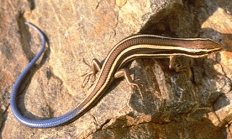
The Western whiptail is found in eastern Oregon deserts and semi-arid shrublands. It is most common in flat, sandy areas and along dry washes. These lizards are primarily insectivorous. In a food habits study in southeastern Oregon, they ate caterpillars, crickets, grasshoppers, and beetles. They also eat spiders, scorpions, and other lizards. Photo by Keith Kohl, ODFW

The plateau striped whiptail is a medium-sized, all-female species. Reproduction is by parthenogenesis - unfertilized eggs hatch into clones of the mother. In Oregon, this lizard only lives in Cove Palisades State Park. Photo by J. N. Stuart, Flickr

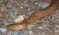
The rubber boa occurs in a variety of habitats, from desert scrub, foothill woodlands, and grasslands through deciduous and coniferous forests. In the Coast Range, it is found commonly in forest clearings that contain rotting stumps and logs. It is absent from the immediate vicinity of the coast north of Coos Bay. Rubber boas are constrictors and eat small mammals, especially young mice and shrews. Photo by Simon Wray, ODFW
