Search myodfw.com


This cavity-nesting thrush is one of three bluebird species found only in North America. Previously abundant in western Oregon, the Western bluebird suffered a precipitous decline through degradation of habitat and avian competition. The male has a cobalt blue head and throat, blue wings and tail edged with dusky brown, russet breast and flanks, gray-blue belly and undertail coverts. Female colorations are subdued: head and throat gray, back gray-brown, wings and tail pale blue, breast and flanks pale russet. The amount and brightness of blue and russet are brighter on older birds. The Western bluebird breeds in open habitats with…

The skies near favored stopover locations are filled twice annually with the sights and sounds of these geese as they migrate between Arctic breeding grounds and wintering areas farther south. Snow geese share very similar all-white plumage and black wing tips with the less common Ross's goose. These are Oregon's only wild white geese. It is predominantly a spring and fall migrant, especially abundant in large wetland and agricultural complexes such as Malheur National Wildlife Refuge, Silvies River floodplain in Harney County, Lower Klamath National Wildlife Refuge and Klamath Wildlife Area. Wintering snow geese in Oregon are found primarily along…

Features: The color of all trout varies with environment. In general, the rainbow is bluish-green on the back, silvery on the sides and belly, and has a white edge to the dorsal, anal, and pelvic fins. A generous sprinkling of black spots appear along the back, and on the dorsal, adipose and caudal fins. A pinkish band usually extends along the sides. Habitat: Rainbow trout are the most widely stocked and distributed trout in Oregon. They occur naturally in many rivers and streams, and each year ODFW stocks millions more in ponds, lakes and streams. Prime trout waters are clear…


NW WILDLIFE VIEWING January 15, 2026 Tillamook County Birds Large numbers of waterfowl arrive before November and will likely spend the rest of the winter here. They will raft up out in the middle of most local estuaries on calm days but will move around with the incoming tide and on windy days. Many species of diving ducks can be seen on area lakes and bays. Likewise, many migrating geese are beginning to arrive and are using area fields, along with many egrets, herons and wintering raptors. Pastures and fields are heavily used by a variety of waterfowl when flooded…

Each year, ODFW stocks millions of trout in dozens of reservoirs, lakes and ponds throughout the state. You can use the search and filter functions to search the stocking schedule for specific locations and dates. The schedule is subject to change without notice; see individual waterbody listings in the Recreation Report for updates.
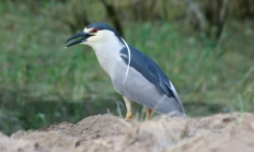
Although quite common in the U.S., the Black-crowned night-heron's nocturnal and crepuscular feeding habits can make it difficult to locate. Its habitat consists of marshes, lakes, rivers, and other wetlands, where it feeds mostly on fish. It is a thick-billed, medium-sized, stocky heron with relatively short neck and legs. Adults have a black back and cap which contrast with the pale gray or whitish underparts. Immatures have brown backs with large pale spots and heavily streaked underparts. A distinctive choking squawk call is often heard at dusk. It is a fairly common summer resident east of the Cascades where it…

Features: Greater sage-grouse are a large grouse species. They are mottled gray-brown with black undersides. Males have black on the head and throat, while females have white behind their eyes. Habitat: Sage-grouse were originally found through much of the sagebrush dominated areas of eastern Oregon, but were eliminated from large areas by the mid 1900s through conversion of land for agricultural purposes. There has been little change in sage-grouse range, however since the 1950s. They live exclusively in sagebrush steppe habitat. During dry years, they may be concentrated in the vicinity of water sources. Technique: Due to greater sage-grouse fluctuating…

The bobcat is the smallest wild felid in Oregon, with females being considerably smaller than males. The bobcat is about twice the size of a domestic cat, but its legs are longer, its tail is shorter, and its body is more muscular and compact. The feet are relatively small and the bobcat is not well adapted to negotiate deep snow. In general, the variously spotted pelage is yellowish with grayish overtones in winter and with reddish overtones in summer, reflecting the two annual molts. The ears are black with a large white spot and are equipped with short black tufts…

SALEM, Ore. – Razor clam harvesting is now open from the Washington/Oregon border to Cape Blanco, the Oregon Department of Agriculture and the Oregon Department of Fish and Wildlife announced today. Razor clamming had been closed from Cascade Head to the California border. But marine biotoxin levels have tested below…

The coyote is a typical canid intermediate in size between the foxes and the gray wolf. The pelage of the coyote is grayish, buff, pinkish cinnamon, or brownish, or a combination of those colors, often overlain by blackish tipped hairs on the ears, muzzle feet, and dorsum. The lips and eyelids are black, accentuated by contrasting borders of white fur. The underparts are paler than the remainder of the body. Considerable variation in color and markings of coyotes is evident among individuals and regionally east and west of the Cascade Range. True albinos with pink eyes and pink foot pads…

